BC Highway 93 – Road Conditions report from USA Hwy 93 Montana through BC to Highway 1 Alberta.
| Highway 93, in both directions. Construction work between Radium Hill Rd and Stanley St for 3.1 km (Radium Hot Springs). Until Fri Oct 31. From 6:00 AM to 4:00 PM MDT on weekdays. Single lane alternating traffic. Single lane alternating traffic Oct 27 - Oct. 31st from 7:00 AM to 6:00 PM. Traffic reduced to 50 km/hr. Last updated Mon Oct 27 at 9:34 AM MDT. minor construction | last updated |
| Highway 93, in both directions. Utility work between West Boundary of Kootenay National Park and McKay Creek Maint for 1.4 km (4 to 3 km north of Radium Hot Springs). Until Fri Oct 31. From 7:00 AM to 7:00 PM MDT daily. Expect 15 - minute delays. Periodic single lane traffic and intermittent closures. Periodic weekend & overnight work. Lane diversions onto shoulder. Lane width and speed limit reductions. Wide loads report to Parks Canada for approval. Last updated Thu Oct 9 at 11:54 minor construction | last updated |
| Highway 93, in both directions. Utility work between Moan Rd and Farstad Way for 9.0 km (2 km south of Skookumchuck to 5 km north of Wasa). Until Wed Nov 5. From 7:00 AM to 6:00 PM MDT daily. Single lane alternating traffic. Shoulder closed. Watch for traffic control. No work scheduled October 23rd to October 27th. Last updated Mon Oct 20 at 8:11 PM MDT. minor construction | last updated |
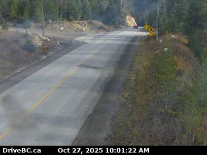
| Highway 93, southbound. Construction work between Settlers Rd and McKay Creek Maint for 3.5 km (15 to 12 km north of Radium Hot Springs). Until Fri Oct 31. From 7:00 AM to 5:00 PM MDT daily. Shoulder closed. Right lane closed. Watch for traffic control. Last updated Mon Oct 27 at 8:25 AM MDT. minor construction | last updated |
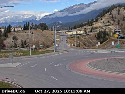
Radium Hotsprings Northbound – Hwy 93/95 roundabout, at Radium Hot Springs, looking northbound on Hwy 95.
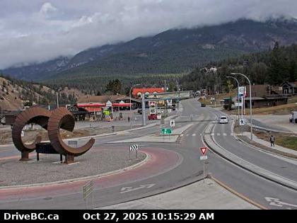
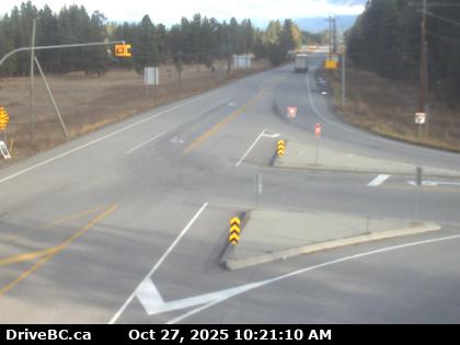
Radium Hotsprings Eastbound – Hwy 93/95 roundabout, at Radium Hot Springs, looking eastbound on Hwy 93.
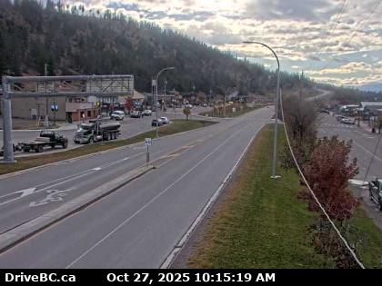
Radium Hotsprings Southbound – Hwy 93/95 roundabout, at Radium Hot Springs, looking southbound on Hwy 93/95.
Panorama West – On Toby Creek Road at Panorama Fire Hall, near Springs Creek Rd, looking to the west.
Panorama East – On Toby Creek Road at Panorama Fire Hall, near Springs Creek Rd, looking to the east.
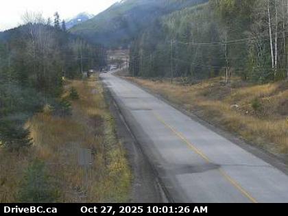
Canal Flats – Hwy 93 at Burns Avenue, looking south on Highway 93.
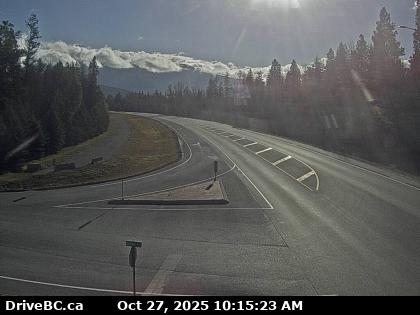
Wasa – Hwy 93/95 at junction of Hwy 95A, looking to the north.
Highway 93 is a north–south route through the southeastern part of British Columbia, in the Regional District of East Kootenay and takes its number from U.S. Highway 93 that it connects with at the Canada–United States border. It follows the Crowsnest Highway (Highway 3) and Highway 95 through Radium Hot Springs and to where it crosses the Continental Divide into Alberta at Vermilion Pass, where it continues as Alberta Highway 93. The section between the Canada-U.S. border and the Crowsnest Highway is known as the Elko–Roosville Highway, the section between the Crowsnest Highway and Radium Hot Springs is known as the Kootenay–Columbia Highway, while the section east of Radium Hot Springs is known as the Banff–Windermere Parkway.
From the international border crossing at Roosville, the 321 km (199 mi) long Highway 93 parallels the eastern shore of Lake Koocanusa for 36 km (22 mi) to where it meets the Crowsnest Highway (Highway 3) at Elko. Highway 3 carries Highway 93 west for 53 km (33 mi) to where it is handed off to Highway 95 just south of Fort Steele. Highway 95 carries Highway 93 north for another 134 km (83 mi) along the Kootenay River and the Columbia River passing through Wasa, Canal Flats, Fairmont Hot Springs and Invermere to Radium Hot Springs, where Highway 95 diverges north towards Golden.
Highway 93 leaves the concurrence and proceeds east from Radium Hot Springs for about 1.3 km (0.8 mi) to the western gate of Kootenay National Park. Through the park, the highway travels northeast along the Kootenay and Vermilion rivers for 93 km (58 mi) to Vermilion Pass and the Alberta border, where it is continues as Alberta Highway 93. After crossing the border, the highway continues for another 11 km (7 mi) to meet the Trans-Canada Highway (Alberta Highway 1) near Castle Junction.