• Skip to primary navigation
  • Skip to main content
  • Skip to primary sidebar

British Columbia Highway News

Integrating BC Transportation Travel News Services and Products

  • BC Road Report News
  • Closures & Incidents
  • Mountain Pass Webcams
  • Canada / USA – Border Cameras
  • About us

Road Reports

Highway 21 Road Conditions

by

BC Highway 21 Road Conditions for the Creston-Rykerts Highway from Creston BC to the USA Idaho Border.

Border Cams and Border Information

Highway 21 the Creston-Rykerts Highway is only 14 km (9 mi) long. It travels northwest along the Kootenay River from its connection with Idaho State Highway 1 at the Rykerts Canada-U.S. border crossing to a point on the Crowsnest Highway (Highway 3) just 1 km (about ½ mi) west of Creston BC.

Filed Under: Road Reports

Highway 12 Road Conditions

by

BC Highway 12 road conditions reports from Highway 99 in Lillooet to Highway 1 in Lytton (Lytton-Lillooet Highway).

Road Condition Reports and Cameras for BC Highway 99

Highway 1 Trans Canada Highway Road Conditions

Ham Radio Repeater VE7HGR

Highway 12 Conditions

Filed Under: Road Reports

Highway 10

by

Highway 10, eastbound. Utility work planned at 192 St (Surrey). Starting Mon Apr 3 until Fri May 12. From 7:00 AM to 5:00 PM PST on weekdays. Right lane will be closed.
minor construction | last updated Wed Feb 1 at 9:24 AM PST.
Highway 10, in both directions. Utility work at King George Blvd. Until Fri May 12 at 6:00 AM PDT. Lane closures in both directions in effect. Watch for traffic control.
minor construction | last updated Mon Feb 13 at 10:47 AM PDT.

Filed Under: Road Reports

Road Reports Secondary Routes

by

BC Road Reports Secondary Routes defined by DriveBC as “Other Roads”.

These include Soda-Creek Macalister Road, Quesnel Hydraulic Road, West Fraser Road, Kersley-Dale Landing Rd, Durrell Road, Quesnel-Hixon Road, Church Road, Allenby Road, Fulford Ganges Road, Isabella Point Road, Highline Rd, Sooke Rd, Sylvester Rd, Bridgeport Rd, Rose Rd, Old Alaska Highway, Deadman Vidette Road, Eastside Road, Dog Creek Road, Cypress Bowl Rd, Pavilion-Clinton Road, King George Blvd, Mabel Lake Road, Rice Road Bridge, Old Hedley Rd, Mission Wycliff Rd, Mission Mountain Road.

Lakelse Avenue. Bridge construction at Old Skeena River Bridge in Terrace. Until Fri Sep 22, 2023. Road closed because of bridge maintenance. The bridge will be closed to all vehicle and foot traffic. Access across the river will be maintained via the Highway 16 Dudley Bridges throughout the project.
minor construction | last updated Wed Jul 20 at 8:47 AM PDT.
Chaumox Road, in both directions. Road maintenance work planned between North Bend and Boston Bar Landfill. Starting Mon Mar 27 until Fri Apr 7. From 8:00 AM to 5:00 PM PDT on weekdays. Single lane alternating traffic will be in effect. For geotechnical drilling. Expect a 2-hour closure on April 3rd from 10am-12pm and April 6th from 8am-10am.
minor construction | last updated Wed Mar 15 at 11:12 AM PDT.
Allenby Road. Mudslide between Miller Road and Boys Road. Road closed. Assessment in progress. Alternate routes available.
major incident | last updated Thu Mar 2 at 4:45 PM PST. | next update Tue May 2 at 3:00 PM PST.
Quesnel-Hixon Road, in both directions. Landslide at Cottonwood bridge. Road closed.
major incident | last updated Wed Mar 15 at 1:59 PM PDT. | next update Fri Apr 14 at 2:00 PM PDT.
Johnston Bridge. Travel advisory in effect at Front St. In Quesnel. Bridge is open to vehicles with gross vehicle weight rating of 10,000 kilograms or lower. Industrial traffic and heavy commercial traffic must detour via Plywood Rd and Maple Drive. Industrial traffic is not allowed to detour through Johnston Subdivision.
major incident | last updated Wed Dec 7 at 2:44 PM PST. | next update Wed Jun 7, 2023 at 2:00 PM PST.
Jingle Pot Road, in both directions. Construction work between Allsop Rd and W Rd in Nanaimo. Until Thu Jun 1 at 5:00 PM PST. From 7:00 AM to 5:00 PM PST on weekdays. Speed limits through the construction area are reduced to 30 km/h for the duration of work, to allow for the safe movement of construction vehicles into and out of the site. Estimated time of re-opening Thu Jun 1 at 5:00 PM PST.
major construction | last updated Wed Mar 1 at 1:03 PM PST. | next update Thu Jun 1 at 5:00 PM PST.
Soda-Creek Macalister Road, in both directions. Landslide at 10 kms from the Junction of Highway 97. Road closed. Geotech assessment underway.
major incident | last updated Wed Mar 15 at 2:00 PM PDT. | next update Fri Apr 14 at 2:00 PM PDT.
Kersley-Dale Landing Rd. Landslide at 500 metres in from Highway 97 Intersection. Road closed. A temporary Single Lane Gravel Road for Local Traffic via Arnoldus Road.
major incident | last updated Wed Mar 15 at 2:00 PM PDT. | next update Fri Apr 14 at 2:00 PM PDT.
Durrell Road, in both directions. Landslide at 700m from Highway 97. Road closed. Detour in effect. Detour available via Highway 97 and Dale Lake Road.
major incident | last updated Wed Mar 15 at 2:00 PM PDT. | next update Fri Apr 14 at 2:00 PM PDT.
Bella Coola . Utility work at City center. Utility work in downtown core on all roads. Expect delays.
minor construction | last updated Thu Mar 23 at 4:34 PM PDT.
Bella Coola. Utility work at City Center. Until Wed May 31 at 9:00 PM PDT. Utility work in downtown core to 5kms Eastbound. Expect delays.
minor construction | last updated Thu Mar 23 at 4:34 PM PDT.
Main Street, in both directions. Construction work between Hwy 1 and Mountain Hwy. Until Fri Mar 31. From 7:00 PM to 5:00 AM PDT on weekdays. Lane Closure. Watch for traffic control.
minor construction | last updated Tue Mar 21 at 8:31 AM PDT.
West Fraser Road , in both directions. Washout at Narcosli Creek 20 km south of Quesnel. The road is closed. Detour in effect via Garner Road and Webster Lake Road. No estimated time of re-opening.
major incident | last updated Wed Nov 30 at 7:11 PM PST. | next update Fri Jun 16, 2023 at 8:00 AM PST.
Northfield Road, in both directions. Shoulder maintenance between Highway 19 and Boxwood Road. Until Sat Apr 1 at 3:00 PM PST. From 9:00 AM to 3:00 PM PST on weekdays. Speed reduction to 30 km/h.
minor construction | last updated Wed Jan 4 at 4:36 PM PST.
Youngsberg Road, in both directions. Bridge construction at Youngsberg Bridge. Road closed. Estimated time of opening not available. No vehicle or pedestrian crossing available.
major construction | last updated Tue Jan 10 at 10:21 AM PST. | next update Fri Mar 31 at 9:00 AM PST.
Phibbs Exchange, in both directions. Construction work at the vicinity of Phibbs Exchange until Spring 2024. Sidewalk users should expect sidewalk closures and detours throughout the duration of the project.
minor construction | last updated Wed Feb 15 at 7:24 PM PST.
Old Hope Princeton Way, in both directions. Utility work at 6th Avenue in Hope. Until Fri Mar 31. From 8:00 AM to 3:30 PM PST daily. Watch for traffic control. Expect minor delays.
minor construction | last updated Mon Feb 27 at 3:12 PM PST.
Departure Bay Road, southbound. Construction work between Island Hwy N and Highland Blvd in Nanaimo. Until Fri Mar 31 at 6:00 AM PST. From 6:00 PM to 6:00 AM PST on weekdays. Night time construction work. The SB exit lane from Departure Bay Road onto Island Highway north bound will be closed. Use Estevan Road, and Brechin Road to access the highway.
minor construction | last updated Mon Feb 27 at 10:06 AM PST.
Mary Ellen Drive. Construction work between Island Hwy N and Nanaimo Pkwy in Nanaimo. Until Fri Mar 31 at 6:00 AM PST. From 5:00 AM to 6:00 PM PST on weekdays. The road is closed. Closure Mon. Thru Fri. From 6PM to 6AM, excluding weekends and holidays. Motorists traveling between Island Hwy N and Nanaimo Pkwy should use Aulds Rd. During the closure.
major construction | last updated Tue Feb 7 at 4:28 PM PST. | next update Fri Mar 31 at 6:00 AM PST.
Burnside Rd West, in both directions. Utility work planned between Highway 1 Exit Ramp and Watkiss Way. Starting Tue Mar 28 at 10:00 PM PDT until Wed Mar 29 at 6:00 AM PDT. Road closure planned. Watch for traffic control personnel.
major construction | last updated Tue Mar 14 at 8:18 AM PDT. | next update Wed Mar 29 at 6:00 AM PDT.
Lillooet Rd, in both directions. Utility work between Spruce St and Chehalis St. Until Fri Mar 31 at 4:30 PM PST. Single lane alternating traffic. Watch for traffic control.
minor construction | last updated Wed Feb 22 at 1:51 PM PST.
Chaumox Road. Construction work planned between Boston Bar Landliff and North Bend near Yale. Starting Wed Mar 29 until Fri Mar 31. From 8:00 AM to 5:00 PM PST on Wednesday, Thursday and Friday. Watch for traffic control personnel. Expect closures of up to 2 hours.
major construction | last updated Mon Feb 27 at 4:17 PM PST. | next update Fri Mar 31 at 5:00 PM PST.
Chaumox Road, in both directions. Construction work planned between Boston Bar Landfill and North Bend near Yale. Starting Mon Mar 27 until Wed Apr 12. From 8:00 AM to 5:00 PM PST daily. Watch for traffic control personnel.
minor construction | last updated Mon Feb 27 at 4:19 PM PST.
Hwy 3. Tree pruning between Meadows Junction and Woodchuck Bridge 1 km north of Salmo. Until Fri Mar 31. Single lane alternating traffic. Watch for traffic control. 7:00am to 5:00pm daily.
minor construction | last updated Mon Mar 20 at 10:07 AM PDT.
Old Alaska Highway. Geotechnical investigation at Kiskatinaw Curved Bridge 30 km north of Dawson Creek. Bridge closed. Slide impacting bridge structure, assessment underway.
minor construction | last updated Thu Mar 23 at 7:05 PM MST. | next update Mon May 1 at 2:30 PM MST.
Glenora Rd., in both directions. Utility work at S'eshia Rd. Until Fri Mar 31. From 7:30 AM to 5:00 PM PDT on weekdays. Single lane alternating traffic. Watch for traffic control.
minor construction | last updated Sun Mar 19 at 7:07 PM PDT.
Miller Rd., in both directions. Utility work at Koksilah Rd. Until Sun Apr 30. From 9:00 AM to 3:00 PM PDT on weekdays. Single lane alternating traffic. Watch for traffic control.
minor construction | last updated Sun Mar 19 at 7:07 PM PDT.
Highway 91 Connector, westbound. Road construction work at Nordel Way. Until Fri Apr 14 at 5:00 AM PDT. From 11:00 PM to 5:00 AM PDT on weekdays. Entrance ramp closed. Detour south via Hwy 91C and Nordel Way to Hwy 91C eastbound onramp to Hwy 91 to 64 Ave exit back to Hwy 91 northbound to exit 8 Nordel Way westbound.
major construction | last updated Thu Mar 16 at 9:59 AM PDT. | next update Fri Apr 14 at 5:00 AM PDT.
HWY 97, in both directions. Road maintenance work between CANIM HENDRIX LAKE ROAD and CARIBOO AVE 1 km north of 100 Mile House. Until Fri Mar 24 at 8:00 PM PDT. Because of road sweeping.
minor construction | last updated Fri Mar 24 at 2:02 PM PDT.
Highline rd , in both directions. Compact snow between Pemberton Portage Rd and Ponderosa Rd in Lillooet. Watch for slippery sections.
minor road condition | last updated Fri Mar 24 at 11:13 AM PDT.
MISSION MOUNTAIN . Compact snow between MISSION DAM and SHALATH CUT OFF near Lillooet. Watch for slippery sections.
minor road condition | last updated Fri Mar 24 at 11:13 AM PDT.
Canal Rd., in both directions. Geotechnical investigation at Mt Norman Access Rd.. Single lane alternating traffic. Watch for traffic control. Expect delays. Slow down to 20km/hour.
minor construction | last updated Fri Mar 24 at 11:16 AM PDT. | next update Fri Mar 31 at 9:30 AM PDT.
Cypress Bowl Rd, in both directions. Paving operations planned between Cypress Place and Deer Ridge Road. Starting Sun Mar 26 at 8:00 PM PDT until Mon Mar 27 at 6:00 AM PDT. Single lane alternating traffic will be in effect. Expect delays.
minor construction | last updated Thu Mar 23 at 2:25 PM PDT.
Highway 91C, westbound. Road construction work planned at Nordel Way offramp. Starting Sun Apr 16 at 1:00 AM PDT until Sun Apr 16 at 4:00 AM PDT. Exit ramp will be closed. Detour planned. Follow signs for River Road west and return to Highway 17 westbound via the River Road roundabout. Take the interchange ramp to Highway 91C eastbound and exit at Nordel Way west.
major construction | last updated Fri Mar 17 at 2:30 PM PDT. | next update Sun Apr 16 at 4:00 AM PDT.
Comox Valley Parkway. Road sweeping between union road and Highway 19A 1 km north of Courtenay. Until Fri Mar 24 at 5:00 PM PDT. Watch for traffic control.
minor construction | last updated Fri Mar 24 at 8:15 AM PDT.
Tunkwa Lake Road, in both directions. Road construction work at 1 km S of Hwy 1. Until Fri Mar 24 at 5:00 PM PDT. From 8:00 AM to 5:00 PM PDT on weekdays. Single lane alternating traffic. Expect minor delays.
minor construction | last updated Fri Mar 24 at 2:18 AM PDT. | next update Fri Mar 24 at 5:15 PM PDT.
Halston Ave, westbound. Electrical maintenance planned at Halston Bridge in Kamloops. Starting Mon Apr 3 at 7:00 AM PDT until Fri Apr 21 at 5:00 PM PDT. From 7:00 AM to 5:00 PM PDT on weekdays. Westbound lane will be closed. Watch for traffic control personnel. Expect delays. 10 Minute delays.
minor construction | last updated Mon Mar 20 at 6:55 PM PDT.
Halston Ave, eastbound. Electrical maintenance planned at Halston Bridge in Kamloops. Starting Mon Mar 27 at 7:00 AM PDT until Fri Mar 31 at 5:00 PM PDT. From 7:00 AM to 5:00 PM PDT on weekdays. Eastbound lane will be closed. Watch for traffic control personnel. Expect delays. 10 Minute delays.
minor construction | last updated Mon Mar 20 at 6:55 PM PDT.

BC Highway Routes Menu Page

Filed Under: Road Reports

Cecil Lake Road Conditions

by

Cecil Lake Road Conditions report Highway 97 Fort St John to Cecil Lake including the Cecil Lake Weather Cam

Cecil Lake Road – at 243rd Rd, looking to the east.

BC Road Report for Highway 97

Fort St John Weather and Road Condition Cameras

Cecil Lake Trails Hiking Loop

Filed Under: Cameras, Road Reports

Atlin Highway Conditions

by

BC Atlin Highway Conditions Report for the Atlin Hwy

Atlin Hwy. Frost heaves between Discovery Ave and Yukon Border for 50.8 km.
minor weather condition | last updated Fri Mar 24 at 6:46 AM PDT.

Highway 37 Road conditions to the Yukon

Yukon Road Reports

Filed Under: Road Reports

Highway 27 Road Conditions

by

BC Highway 27 Road Conditions for the Stuart Lake Highway including Road Condition and Weather Cams.

Highway 27 Road Condition and Weather Cameras

Fort St James North – Hwy 27 at Hill St/Greenview in Fort St. James, looking to the north.

Fort St James South – Hwy 27 at Hill St/Greenview in Fort St. James, looking to the north.

Spencer Pit North – Highway 27, about 12km south of Fort St. James at Spencer Pit, looking to the north.

Spencer Pit South – Highway 27, about 12km south of Fort St. James at Spencer Pit, looking to the south.

Stuart Lake Highway N – Hwy 27, about 32 km south of Fort St. James, looking looking to the north.

Stuart Lake Highway S – Hwy 27, about 32 km south of Fort St. James, looking looking to the south.

Highway 27, the Stuart Lake Highway, is a 53 km (33 mi) long spur of the Yellowhead Highway in the Regional District of Bulkley-Nechako. First opened in 1967, it provides a connection from Vanderhoof, on Highway 16, north to Fort St. James, at the southern end of Stuart Lake. BC Highway 27 Road Conditions

Stewart Lake Marine Park

Filed Under: Cameras, Road Reports

Highway 31A Road Conditions

by

Highway 31A Road Conditions

Highway 31A. Watch for slippery sections between Retallak and Junction Hwy 31 for 27.0 km (19 km east of New Denver to Kaslo).
minor road condition | last updated Fri Mar 24 at 6:57 AM PDT.

Retallack – Highway 31A, at Retallack between New Denver and Kaslo, looking to the west.

Highway 31 Road Condition Report

Ham Radio Frequencies for the Kootenays

Filed Under: Cameras, Road Reports

Highway 29 Road Conditions

by

BC Highway 29 Road Conditions

Highway 29, in both directions. Road maintenance work between Farrell Creek Bridge and Upper Cache Rd for 3.5 km (Halfway Rest Area). Until Fri Mar 31. From 7:00 AM to 6:00 PM MST daily. Single lane alternating traffic. Watch for traffic control. Expect delays.
minor construction | last updated Tue Mar 21 at 12:55 PM MST.
Highway 29. Watch for slippery sections between the start of Highway 29 and Lone Prairie Rd for 46.2 km (Tumbler Ridge).
minor road condition | last updated Fri Mar 24 at 11:11 AM MST.

BC Highway 97 Accurate Road Condition Reports

Highway Weather Cams for Chetwynd

In Tumbler Ridge, the 237 km (147 mi) long Highway 29 starts at a junction with Highway 52 Road Conditions, and travels north northwest for 94 km (58 mi) to its junction with the John Hart Highway at Chetwynd. It follows the John Hart Highway through Chetwynd for 3 km (2 mi) east, then turns northwest for 65 km (40 mi) past Moberly Lake to Hudson’s Hope, where a connector road to the W. A. C. Bennett Dam begins. 75 km (47 mi) northeast of Hudson’s Hope, Highway 29 finally meets the Alaska Highway north of Fort St. John near Charlie Lake.

Alaska Highway Road Conditions

Filed Under: Road Reports

Highway 7B Road Conditions

by

Highway 7B Road Conditions and Traffic Cameras

Highway 7B Road Conditions for the Mary Hill Bypass

Highway 7 – The Loughheed Hwy Road Condition Reports

Maryhill Bypass Road and Weather Condition Traffic Cams

Cameras provided by DriveBC

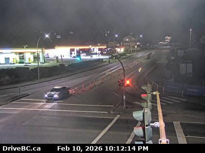
Shaughnessy W – Hwy 7B/Mary Hill Bypass at Shaughnessy St looking to the west.

Shaughnessy E – Hwy 7B/Mary Hill Bypass at Shaughnessy St looking to the east.

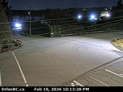
Pitt River N – Hwy 7B (Mary Hill Bypass), at Pitt River Rd, looking to the north.

Pitt River W – Hwy 7B (Mary Hill Bypass), at Pitt River Rd, looking to the West.

Pitt River E – Hwy 7B (Mary Hill Bypass), at Pitt River Rd, looking to the East.

Pitt River S – Hwy 7B (Mary Hill Bypass), at Pitt River Rd, looking to the South.

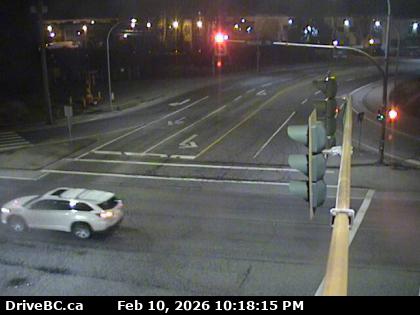
Broadway Port Coquitlam N – Hwy 7B (Mary Hill Bypass), at Broadway St in Port Coquitlam, looking to the North

Broadway Port Coquitlam W – Hwy 7B (Mary Hill Bypass), at Broadway St in Port Coquitlam, looking to the West

Broadway Port Coquitlam E – Hwy 7B (Mary Hill Bypass), at Broadway St in Port Coquitlam, looking to the East

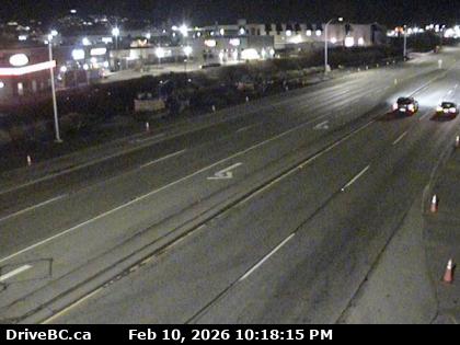
On Mary Hill – Hwy 7B, on Mary Hill at Kingsway Ave, looking to the West.

On Mary Hill – Hwy 7B, on Mary Hill, looking to the East.

RCMP Coquitlam

Filed Under: Cameras, Road Reports

  • Go to page 1
  • Go to page 2
  • Go to page 3
  • Interim pages omitted …
  • Go to page 10
  • Go to Next Page »

Primary Sidebar

News

How to go to the USA.

The rules imposed by the United States Dec 2 2021 requiring a test 24hours before flying to the USA do not apply at the land border however You are still required to be fully vaccinated to drive to USA.

Driving to Canada

Canadian Covid -19 Emergency border measures have ended.

Best Personal Breathalyzer

Personal Breathalyzer
Dont risk a DUI. Make sure you don’t drive while impaired Get a personal breathalyzer check your alcohol levels and drive responsibly.


This 'travel news' services website is privately owned. It is not affiliated or sanctioned by the Government of BC, nor is it part of the provincial governments - DriveBC program or websites, operated by the BC Ministry of Transportation and Infrastructure. The data and electronic links provided in this web site are for informational purposes only and bchighway.com disclaims all responsibility for the accuracy of site content or linked information. This information obtained from bchighway.com should not be used as a basis for making financial or other commitments. Privacy Agreement © 1996–2023 bchighway.com - All Rights Reserved.