• Skip to primary navigation
  • Skip to main content
  • Skip to primary sidebar

British Columbia Highway News

Integrating BC Transportation Travel News Services and Products

  • BC Road Report News
  • Closures & Incidents
  • Mountain Pass Webcams
  • Canada / USA – Border Cameras
  • About us

Cameras

Highway 2 Road Conditions

by

BC Highway 2 Road Conditions the Tupper Highway Road Report

Tupper Highway West – Hwy 2, 2 km west of BC/Alberta border at Hwy 2 and Hwy 52 junction, looking west.

Tupper Highway East – Hwy 2, 2 km west of BC/Alberta border at Hwy 2 and Hwy 52 junction, looking east.

Highway 97 Road Report through Chetwynd

British Columbia Highway 2, known locally as the Tupper Highway, is one of the two short connections from Dawson Creek to the border between B.C. and Alberta. The Tupper Hwy is 42 km (26 mi) long.

Highway 2 starts in Dawson Creek at its junction with Highway 97, and proceeds southeast for 39 km (24 mi) past the small settlement of Pouce Coupe, to its junction with Highway 52 near Tupper. The highway connects with Alberta Highway 43 at the provincial border, 3 km (2 mi) southeast of Tupper. Highway 2 Road Conditions.

Highway 49 Spirit River Highway Road Conditions

Dawson Creek Ham Radio Repeaters

Filed Under: Cameras, Road Reports

Pennask Summit Weather Camera

by

Pennask Summit Weather Camera Highway 97C

Pennask Summit – Hwy 97C (Okanagan Connector), about 74 km west of Kelowna, looking east.

Road Report Conditions for BC Highway 97C

Pennask Summit (el. 1728 m, 5669 ft) is a highway summit along the Okanagan Connector in British Columbia, Canada, crossing the forested uplands of the Thompson Plateau. It is the highest point on the highway between the cities of Merritt and Peachland. It is the second highest mountain route used by a highway in British Columbia, after Kootenay Pass. It is located 49 km (30 mi) east of Aspen Grove, and 33 km (21 mi) west of the highway junction in Peachland/Westbank.

Pennask Summit Weather Camera Pennask Lake Provincial Park

Filed Under: Cameras

Highway 97C Weather Cameras

by

BC Highway 97C Weather Cameras for the Okanagan Connector

Road Condition Reports for the Coquihalla Hwy5 and Highway 97C

Highland Valley Road – Hwy 97C, at Highland Valley Rd, about 61 km north of Merritt and 46 km south of Ashcroft, looking north.

Okanagan Connector Cameras

Aspen Grove North – Hwy 97C (Okanagan Connector), at Hwy 5A Junction, near Aspen Grove, looking north.

Aspen Grove South – Hwy 97C (Okanagan Connector), at Hwy 5A Junction, near Aspen Grove, looking south.

Pothole Lake West – Hwy 97C (Okanagan Connector), near Pothole Lake about 7 km east of Aspen Grove, looking west.

Pothole Lake East – Highway 97C Weather Cameras (Okanagan Connector), near Pothole Lake about 7 km east of Aspen Grove, looking east.

Elkhart West – Hwy 97C (Okanagan Connector), about 25 km east of Hwy 5A/97C Junction, looking west.

Elkhart East – Hwy 97C (Okanagan Connector), about 25 km east of Hwy 5A/97C Junction, looking east.

Pennask Summit – Hwy 97C (Okanagan Connector), about 74 km west of Kelowna, looking east.

Brenda Mine West – Hwy 97C (Okanagan Connector), about 22 km west of 97/97C Junction, looking west.

Brenda Mine East – Hwy 97C (Okanagan Connector), about 22 km west of 97/97C Junction, looking east.

Highway 97C Weather Cameras

Road Condition Reports for the Coquihalla Hwy5 and Highway 97C

Road Conditions BC Highway 5

Road Conditions BC Highway 97

Ham Radio Repeater Covering Hwy 97C

Filed Under: Cameras

Highway 26 Road Conditions

by

BC Highway 26 Road Conditions report for the Barkerville Highway,

Highway 26, eastbound. Maintenance between Cinderella Rd and 72 C Rd (27 km west of Wells). Until Sun Nov 30. From 6:00 AM to 6:00 PM PDT on weekdays and Saturday. Single lane alternating traffic. Watch for traffic control. Culvert replacement will be taking place.
minor construction | last updated Thu Oct 16 at 10:06 AM PDT.
Highway 26. Utility work between Blue Ridge Rd and Reduction Rd for 72.2 km (8 km east of Quesnel to 6 km east of Wells). Until Fri Nov 28. From 6:30 AM to 5:30 PM PST on weekdays and Saturday. Single lane alternating traffic. Vegetation Maintenance. Please watch for traffic control and work crews. Expect minor delays of up to five minutes.
minor construction | last updated Fri Nov 14 at 4:10 PM PST.
Highway 26. Slushy sections between Sorum Rd and Barkerville Hwy for 56.1 km (25 km east of Quesnel to 6 km east of Wells).
minor road condition | last updated Sat Nov 22 at 3:48 PM PST.

Wells BC – Highway 26, near Wells BC, about 78 km east of Quesnel, looking to the west.

Highway 26 is also known as The Barkerville Highway. It is an east-west highway in the North Cariboo region of the Central Interior of British Columbia.

BC Hwy 26 provides access to the community of Wells BC and the famous gold rush town of Barkerville located at the foot of the Cariboo Mountains.

The highway travels west of Barkerville to Quesnel where it meets Highway 97.

Bowron Lakes Provincial Park, a popular canoeing expedition circuit, is accessed by Highway 26.

The cutoff for Bowron Lakes is between Barkerville and Wells; one km prior to arriving at the historic town of, Barkerville. Highway 26 Road Conditions.

Highway 26 Road Conditions

Barkerville, preserved as a historic town, was the main town of the Cariboo Gold Rush. It is located on Highway 26 the Cariboo Mountains 80 kilometres east of Quesnel.

Quesnel is a city located in the Cariboo Regional District of British Columbia. It is located between the cities of Prince George and Williams Lake on Highway 97.

Highway 26 joins Highway 97 in Quesnel. Quesnel is on the main route to northern British Columbia and the Yukon via Highway 97.

Filed Under: Cameras, Road Reports

Highway 24 Road Conditions

by

BC Highway 24 Road Conditions reports for the Little Fort Highway or Interlakes Highway

Highway 24. Limited visibility with fog between Cottage Lane and Junction Hwy 5 for 36.3 km (Little Fort). Watch for slippery sections.
minor weather condition | last updated Sat Nov 22 at 6:31 AM PST.

Sheridan Lake West – Hwy 24, 63 km west of Little Fort, looking to the west.

Sheridan Lake East – Hwy 24, 63 km west of Little Fort, looking to the east.

McDonald Summit – Hwy 24, 15 km west of Little Fort, looking west.

Highway 24 straddles the boundary between the Cariboo and Thompson-Nicola Regional Districts.

It begins in the west at 93 Mile House on Highway 97, approximately 11 km (7 mi) south of 100 Mile House.

The highway passes through the small community of Lone Butte.

After passing several turn-offs to resort lakes including Sheridan Lake, the highway passes through the community of Bridge Lake.

The highway then proceeds another 50 km (31 mi) east through the forest and over a large hill before reaching its terminus in Little Fort BC.

A very historic and scenic drive, the highway follows a historic trail used by the Shuswap people as a trade route and was later developed by the Hudson’s Bay Company in the early 19th century to bring furs from northern BC out to Fort Kamloops and the Columbia River. Highway 24 Road Conditions.
Fishing BC on Highway 24

Filed Under: Cameras, Road Reports

Highway 52 Road Conditions

by

BC Highway 52 Road Conditions for Highway 52 North from Tumbler Ridge through Feller Heights to join Highway 97 west of Arras and Highway 52 East from Tumbler Ridge connecting with Hwy43/ Highway 2 near Tupper.

Hwy 52 East Road Report

Highway 52 E. Watch for slippery sections between Kelly Lake Rd and the end of Highway 52 E for 79.4 km (Tumbler Ridge). Compact snow.
minor road condition | last updated Sat Nov 22 at 3:46 PM MST.

Hwy 52 North Road Conditions

Highway 52 N (Heritage Highway). Watch for slippery sections between 200 Rd and the end of Highway 52 N (Heritage Highway) for 81.7 km (Tumbler Ridge). Compact snow.
minor road condition | last updated Sat Nov 22 at 3:46 PM MST.

Tumbler Ridge – Highway 29 and Highway 52 intersection in Tumbler Ridge Looking to the West on Hwy 29. For other Highway 52 Cameras check Highway 2/52 intersection at Tupper.

Highway 52 is known locally as the Heritage Highway, is a long alternate loop route between Arras, on the John Hart Highway 97 just west of Dawson Creek, and Tupper, on the B.C.-Alberta border. The community of Tumbler Ridge is in the center of the loop so to speak 98 km (61 mi) south of Arras and 145 km (90 mi) south of Tupper. Highway 52 Road Conditions

Filed Under: Cameras, Road Reports

Jack McDonald Snowshed Weather

by

Jack McDonald Snowshed Weather

BC Highway 1 Jack McDonald Snowshed Weather Camera.

Highway 1, about 46 km (28.5 miles) east of Revelstoke, looking to the east.

Road Conditions for all of BC Highway 1

Revelstoke Ham Radio Repeater Frequency

Filed Under: Cameras

Jackass Mountain Weather Cam

by

Highway 1 Road Conditions via the Jackass Mountain Weather Cam at the summit.

Jackass Mountain Weather Camera

Hwy 1 at Jackass Mt. Summit, between Boston Bar and Lytton, looking to the north.

Road Report Conditions for all of BC Highway 1

Filed Under: Cameras

Haida Gwaii – Weather Cams

by

Haida Gwaii weather cams for Haida Gwaii Road Conditions

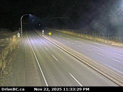
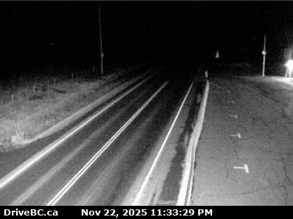
Masset – Hwy 16 at Hodges Road in Masset on Haida Gwaii, looking north.

Tlell – Hwy 16 at Wiggins Rd, on the east coast of Graham Island, looking north.

Skidegate – Hwy 16 at the ferry terminal on Haida Gwaii, looking north.

Ocean View Drive Report:

Ocean View Dr. Water pooling between the start of Ocean View Dr and Queen Charlotte Mainline for 7.5 km (Skidegate to Queen Charlotte).
minor road condition | last updated Sat Nov 22 at 10:45 AM PST.

Haida Gwaii: Road Condition Report and for all of BC Highway 16

For more info on Haida Gwaii visit https://www.indigenousbc.com/

Sandspit Airport Weather Cam

BC Ferry Schedule to Prince Rupert

Haida Gwaii - Weather Cams

Filed Under: Cameras, Road Reports

Rogers Pass – Weather Cam

by

Rogers Pass Weather Cam

Road Report for BC Highway 1

Other Mountain Pass Weather Cams for BC Routes

Rogers Pass is a high mountain pass through the Selkirk Mountains of British Columbia on the Trans-Canada Highway. In the heart of Glacier National Park, this tourism destination since 1886 is a National Historic Site.

Filed Under: Cameras

  • « Go to Previous Page
  • Go to page 1
  • Interim pages omitted …
  • Go to page 4
  • Go to page 5
  • Go to page 6
  • Go to page 7
  • Go to page 8
  • Go to Next Page »

Primary Sidebar

Caribbean Business for Sale

Move to Sint Maarten with this incredible opportunity 

Best Personal Breathalyzer

Personal Breathalyzer
Dont risk a DUI. Make sure you don’t drive while impaired Get a personal breathalyzer check your alcohol levels and drive responsibly.


This 'travel news' services website is privately owned. It is not affiliated or sanctioned by the Government of BC, nor is it part of the provincial governments - DriveBC program or websites, operated by the BC Ministry of Transportation and Infrastructure. The data and electronic links provided in this web site are for informational purposes only and bchighway.com disclaims all responsibility for the accuracy of site content or linked information. This information obtained from bchighway.com should not be used as a basis for making financial or other commitments. Privacy Agreement © 1996–2025 bchighway.com - All Rights Reserved.