• Skip to primary navigation
  • Skip to main content
  • Skip to primary sidebar

British Columbia Highway News

Integrating BC Transportation Travel News Services and Products

  • BC Road Report News
  • Closures & Incidents
  • Mountain Pass Webcams
  • Canada / USA – Border Cameras
  • About us

Road Reports

Northern Routes Road Conditions

by

Northern Routes Road Conditions Reports for British Columbia’s Peace district, Fort George district, Bulkley Stikine district and Skeena highways district.

Paving operations from Highway 97, Mt Solitude to Powder King Rd. Starting Mon Aug 17 until Thu Nov 12. From 7:00 AM to 7:00 PM MST, Monday to Saturday. Single lane alternating traffic. Last update: September 24th, 2026 at 9:52am MST.
minor construction | last updated
Bridge construction at Highway 97, At Beatton River Bridge. Starting 2:03 PM MST on Tuesday September 22, 2026 until 11:59 PM MST on Monday November 30, 2026. Single lane alternating traffic. Width restriction: 3.8m. Length restriction: 27.5m. Height restriction: 5.33m. Weight vehicle restriction: 81,500 kg. Last update: October 29th, 2026 at 7:52am MST. Beatton Bridge Construction, just north of Pink Mountain Road.
minor construction | last updated
Geotechnical investigation at Old Alaska Highway. Assessment in progress. Bridge closed. Last update: September 22nd, 2026 at 2:16pm MST. Next update: November 5th, 2026 at 11:00am MST. Slide impacting bridge.
minor incident | last updated
Bridge maintenance from Highway 97, 255 Road to 259 Road. Starting 7:00 AM MST on Wednesday October 28, 2026 until 7:00 PM MST on Wednesday November 11, 2026. From 7:00 AM to 7:00 PM MST, every day. Single lane alternating traffic. Last update: October 22nd, 2026 at 12:09pm MST.
minor construction | last updated
Utility work from Highway 29, In Hudson's Hope and Peace Canyon Rd W to In Hudson's Hope and Peace Canyon Rd E. Starting 7:00 AM MST on Monday October 26, 2026 until 5:00 PM MST on Friday November 6, 2026. From 7:00 AM to 5:00 PM MST, every day. Single lane alternating traffic. Watch for traffic control. Last update: October 23rd, 2026 at 4:05pm MST.
minor construction | last updated
Ditch maintenance from Highway 97. Starting 7:00 AM MST on Monday October 26, 2026 until 5:00 PM MST on Wednesday November 11, 2026. From 7:00 AM to 5:00 PM MST, Monday to Saturday. Single lane alternating traffic. Last update: November 2nd, 2026 at 7:50am MST. Ditching work planned. Intermittent single-lane alternating traffic will be in effect. Please follow all traffic control directions.
minor construction | last updated
Slippery sections between Fort Nelson River Bridge (96 miles south of British Columbia and Northwest Territory Border) and the end of Highway 77 (British Columbia and Northwest Territory Border). Last update: November 5th, 2026 at 5:39am MST. Next update: November 5th, 2026 at 7:00am MST.
minor road condition | last updated
Slippery sections between the start of Highway 77 and Fort Nelson River Bridge (96 to 138 miles south of British Columbia and Northwest Territory Border). Last update: November 5th, 2026 at 5:39am MST. Next update: November 5th, 2026 at 7:00am MST.
minor road condition | last updated
Slippery sections between Sikanni Road (1 mile south of Fort Nelson) and Pipeline Mainline (1 mile north of Fort Nelson). Last update: November 5th, 2026 at 5:39am MST. Next update: November 5th, 2026 at 7:00am MST.
minor road condition | last updated
Utility work from Highway 29, Cache Creek Bridge (Bear Flat. Starting 7:30 AM MST on Thursday November 5, 2026 until 5:00 PM MST on Sunday November 8, 2026. From 7:30 AM to 5:00 PM MST, Thursday to Sunday. Single lane alternating traffic. Last update: November 3rd, 2026 at 9:49am MST. Cable placing work.
minor construction | last updated
Bridge construction at Highway 29. Starting 7:30 AM MST on Tuesday November 3, 2026 until 5:00 PM MST on Thursday November 5, 2026. From 7:30 AM to 5:00 PM MST, Tuesday to Thursday. Single lane alternating traffic. Watch for traffic control. Last update: November 3rd, 2026 at 9:47am MST.
minor construction | last updated
Slippery sections between Bullmoose Road (42 miles north of Tumbler Ridge) and 53rd Avenue NE (near Chetwynd). Last update: November 5th, 2026 at 4:50am MST. Next update: November 5th, 2026 at 7:00am MST.
minor road condition | last updated
Slippery sections between Weiland Road (near Chetwynd) and Peace Canyon Access Road (6 miles south of Hudson's Hope). Last update: November 5th, 2026 at 4:50am MST. Next update: November 5th, 2026 at 7:00am MST.
minor road condition | last updated
Fog patches between Powder King Road (near Pine Pass Summit) and Old Hasler Road (24 miles south of Chetwynd). Last update: November 5th, 2026 at 4:17am PCT. Next update: November 5th, 2026 at 5:00am PCT.
minor road condition | last updated

Bridge maintenance from Goat River East Pit Road, At Lamco Road to Highway 16, Goat River East Pit Road. Starting 1:31 PM PDT on Wednesday September 23, 2026. Single lane alternating traffic. Watch for traffic control. Expect minor delays. Last update: October 31st, 2026 at 11:11am PDT. Use caution when passing crew and equipment on highway.
minor construction | last updated
Geotechnical investigation from Highway 27, In Fort Street James and At Tachie Road to 10km Northeast of Fort Street James. Last update: November 3rd, 2026 at 11:48am PCT. Next update: January 1st, 2027 at 1:00pm PCT. Closed at the 1.7 kilometer mark. Detour in Effect using the Takla Road to Teardrop Forest Service Road.
minor incident | last updated
Road construction from Highway 5, At Thunder River Road to At Miledge Creek Bridge. Starting Thu Sep 24 until Sat Nov 7. From 8:00 AM to 5:00 PM PDT, weekdays. Watch for traffic control. Last update: September 24th, 2026 at 10:58am PDT. Single Lane Alternating Traffic will only be required for a brief duration during mobilization and demobilization of materials and equipment.
minor construction | last updated
Mowing from Highway 5, At Avola Overhead Bridge to At Blue River Bridge. Starting Thu Sep 24. From 7:00 AM to 7:00 PM PDT, weekdays. Watch for traffic control. Last update: September 24th, 2026 at 11:02am PDT.
minor construction | last updated
Bridge construction at Highway 5, At Six Mile Bridge. Starting 11:00 AM PDT on Thursday September 24, 2026. Last update: October 30th, 2026 at 10:38am PDT. Speed reduction in effect, no other delays or restrictions in place. Please use caution.
minor construction | last updated
Bridge maintenance from Highway 5, At Avola Overhead Bridge to At Avola Bridge. Starting Thu Sep 24. From 6:00 AM to 9:00 PM PDT, weekdays. Single lane alternating traffic. Watch for traffic control. Last update: September 24th, 2026 at 11:11am PDT.
minor construction | last updated
Road maintenance from Highway 16, In Vanderhoof and At Nechako Avenue to At Ryley Avenue. Starting Mon Oct 5 until Sat Nov 7. Shoulder closed. Watch for traffic control. Last update: October 13th, 2026 at 7:44am PDT.
minor construction | last updated
Utility work at Highway 16, In Prince George. Starting 8:00 AM PDT on Monday October 19, 2026 until 4:00 PM MST on Friday November 13, 2026. Right lane closed. Last update: October 21st, 2026 at 1:16pm PDT.
minor construction | last updated
Utility work at Highway 16, In Prince George. Starting 8:00 AM PDT on Monday October 19, 2026 until 4:00 PM MST on Friday November 13, 2026. Right turn lane closed. Last update: October 21st, 2026 at 1:19pm PDT.
minor construction | last updated
Utility work at Highway 16, In Prince George. Starting 8:00 AM PDT on Monday October 19, 2026 until 4:00 PM MST on Friday November 13, 2026. Left turn lane closed. Last update: October 21st, 2026 at 1:21pm PDT.
minor construction | last updated
Utility work at Highway 16, In Prince George. Starting 8:00 AM PDT on Monday October 19, 2026 until 4:00 PM MST on Friday November 13, 2026. Right turn lane closed. Last update: October 21st, 2026 at 1:23pm PDT.
minor construction | last updated
Utility work at Highway 16, In Prince George. Starting 8:00 AM PDT on Monday October 19, 2026 until 4:00 PM MST on Friday November 13, 2026. Left turn lane closed. Last update: October 21st, 2026 at 1:25pm PDT.
minor construction | last updated
Road construction at Highway 5, Little Hells Gate. Starting 8:00 AM PDT on Wednesday October 28, 2026 until 5:00 PM MST on Friday November 6, 2026. Single lane alternating traffic. Watch for traffic control. Last update: October 22nd, 2026 at 11:17am PDT. Lane closures between Little Hell's Gate and Six Mile Bridge.
minor construction | last updated
Geotechnical investigation at Highway 16, 2km Northwest of Slim Creek Rest Area and 75m Northwest of Slim Creek Bridge. Starting 8:00 AM MST on Wednesday November 4, 2026 until 4:00 PM MST on Thursday November 5, 2026. Right lane closed. Centre lane closed. Watch for traffic control. Last update: October 23rd, 2026 at 11:46am PDT.
minor construction | last updated
Utility work from Highway 16. Starting 7:00 AM MST on Monday November 9, 2026 until 5:00 PM MST on Friday November 27, 2026. Single lane alternating traffic. Watch for traffic control. Last update: October 26th, 2026 at 9:33am PDT. Watch for traffic control between Red Pass and Moose Lake Boat Launch.
minor construction | last updated
Special event from Highway 27, In Fort Street James to In Fort Street James. Starting 6:55 PM MST on Friday November 27, 2026 until 8:00 PM MST on Friday November 27, 2026. Watch for traffic control. Last update: October 26th, 2026 at 9:40am PDT. Santa Clause Parade.
minor construction | last updated
Utility work from Highway 97, 200m Northeast of McLeod Road. Starting 9:00 AM PCT on Monday November 9, 2026 until 4:00 PM PCT on Tuesday November 10, 2026. Southbound lane closure. Single lane alternating traffic. Watch for traffic control. Last update: November 3rd, 2026 at 1:07pm PCT.
minor construction | last updated
Bridge maintenance at Highway 16. Starting 7:00 AM PCT on Wednesday November 4, 2026 until 5:00 PM PCT on Thursday November 5, 2026. From 7:00 AM to 5:00 PM PCT, Wednesday and Thursday. Single lane alternating traffic. Watch for traffic control. Last update: November 4th, 2026 at 7:05am PCT.
minor construction | last updated
Tree pruning from pending to Error retrieving municipality. Starting 7:00 AM PCT on Monday November 16, 2026 until 6:00 PM PCT on Friday November 20, 2026. Shoulder closed. Northbound lane closure. Last update: November 4th, 2026 at 9:30am PCT.
minor construction | last updated
Slippery sections between the start of Highway 39 (Mackenzie Junction) and McIntyre Drive (Mackenzie). Last update: November 5th, 2026 at 4:53am PCT. Next update: November 5th, 2026 at 7:00am PCT.
minor road condition | last updated
Slippery sections between Grizzly Avenue (57 miles north of Prince George) and Carp Lake Road (McLeod Lake). Last update: November 5th, 2026 at 4:50am PCT. Next update: November 5th, 2026 at 7:00am PCT.
minor road condition | last updated
Slippery sections between Carp Lake Road (McLeod Lake) and Kloss Road (1 mile south of Mackenzie Junction). Last update: November 5th, 2026 at 4:53am PCT. Next update: November 5th, 2026 at 7:00am PCT.
minor road condition | last updated
Slippery sections between Mitchell Road and Grizzly Avenue (22 to 57 miles north of Prince George). Last update: November 5th, 2026 at 4:50am PCT. Next update: November 5th, 2026 at 7:00am PCT.
minor road condition | last updated
Fog patches between Tudyah Lake Provincial Pk (1 mile south of Mackenzie Junction) and Old Hasler Road (near Pine Pass Summit). Last update: November 5th, 2026 at 4:17am PCT. Next update: November 5th, 2026 at 5:00am PCT.
minor road condition | last updated

Construction work from Highway 16. Starting Mon Sep 28 until Tue Dec 1. From 7:00 AM to 5:00 PM PDT, every day. Expect 10 minutes delay. Expect delays. Lane closures in both directions. Single lane alternating traffic. Watch for traffic control. Speed Limit restriction: 50km. Last update: October 10th, 2026 at 2:29pm PDT. Use caution when passing crew and equipment on highway.
minor construction | last updated
Slippery sections between Cedarvale Ferry Road (17 miles west of Gitsegukla) and Fielding Street (near New Hazelton). Last update: October 27th, 2026 at 3:24pm PDT. Next update: October 27th, 2026 at 4:00pm PDT.
minor road condition | last updated
Slippery sections between New Hazelton Hi-Level Road (near New Hazelton) and Moricetown Overhead Bridge (Witset (Moricetown)). Last update: October 27th, 2026 at 3:24pm PDT. Next update: October 27th, 2026 at 4:00pm PDT.
minor road condition | last updated
Slippery sections between Cedarvale Ferry Road (17 miles west of Gitsegukla) and Fielding Street (near New Hazelton). Last update: October 27th, 2026 at 5:13pm PDT. Next update: October 28th, 2026 at 5:00am PDT.
minor road condition | last updated
Slippery sections between New Hazelton Hi-Level Road (near New Hazelton) and Moricetown Overhead Bridge (Witset (Moricetown)). Last update: October 27th, 2026 at 5:13pm PDT. Next update: October 28th, 2026 at 5:00am PDT.
minor road condition | last updated
Bridge maintenance at Highway 51, 76km Southwest of Dease Lake and 35km Northeast of Telegraph Creek. Starting 8:00 AM PCT on Tuesday November 3, 2026. Expect 4 hours delay. Bridge closed. Last update: October 31st, 2026 at 6:47am PDT. Tuya bridge closed due to a major redeck works. Bridge closed from 8am - 12pm, open from 12pm - 1pm, closed again from 1pm to 5pm then open all night. Starting Nov 3, - Nov 16, 2026. Mon - Friday.
major construction | last updated
Compact snow, Slippery sections and Slushy sections between Bob Quinn Camp and Burrage River Bridge (Bob Quinn). Last update: November 5th, 2026 at 4:49am PCT. Next update: November 5th, 2026 at 7:00am PCT.
minor road condition | last updated
Slippery sections and Compact snow between Burrage River Bridge (35 miles north of Bob Quinn) and Tatogga Lake Resort (Tatogga). Last update: November 5th, 2026 at 4:49am PCT. Next update: November 5th, 2026 at 7:00am PCT.
minor road condition | last updated
Slippery sections and Compact snow between Tatogga Lake Resort (Tatogga) and Stikine Bridge (30 miles north of Iskut). Last update: November 5th, 2026 at 4:49am PCT. Next update: November 5th, 2026 at 7:00am PCT.
minor road condition | last updated
Slippery sections between Stikine Bridge (30 miles north of Iskut) and Commercial Drive (Dease Lake). Last update: November 5th, 2026 at 4:49am PCT. Next update: November 5th, 2026 at 7:00am PCT.
minor road condition | last updated
Slippery sections between Commercial Drive (Dease Lake) and Dease River Bridge (46 miles south of Jade City). Last update: November 5th, 2026 at 4:49am PCT. Next update: November 5th, 2026 at 7:00am PCT.
minor road condition | last updated
Compact snow and Slippery sections between Dease River Bridge and Cassiar Road (Jade City). Last update: November 5th, 2026 at 4:49am PCT. Next update: November 5th, 2026 at 7:00am PCT.
minor road condition | last updated
Compact snow and Slippery sections between Cassiar Road (2 miles north of Jade City) and the end of Highway 37N (British Columbia and Yukon Border). Last update: November 5th, 2026 at 4:49am PCT. Next update: November 5th, 2026 at 7:00am PCT.
minor road condition | last updated
Compact snow and Slippery sections between Stikine Avenue (Telegraph Creek) and Riverview Drive (51 miles west of Dease Lake). Last update: November 5th, 2026 at 4:49am PCT. Next update: November 5th, 2026 at 7:00am PCT.
minor road condition | last updated
Slippery sections between Burnt Trailer/Tanzilla Acc (51 miles west of Dease Lake) and Boulder Avenue (Dease Lake). Last update: November 5th, 2026 at 4:49am PCT. Next update: November 5th, 2026 at 7:00am PCT.
minor road condition | last updated
Compact snow, Slippery sections and Slushy sections between Deltaic Creek Bridge (26 miles south of Bell II) and Bob Quinn Camp (Bob Quinn). Last update: November 5th, 2026 at 4:49am PCT. Next update: November 5th, 2026 at 7:00am PCT.
minor road condition | last updated
Slippery sections and Black ice between Discovery Avenue (Atlin) and the end of Atlin Highway (British Columbia and Yukon Border). Last update: November 5th, 2026 at 6:06am PCT. Next update: November 5th, 2026 at 7:00am PCT.
minor road condition | last updated
Construction work from Highway 37, At Bob Quinn Lake to 10km Southeast of Bob Quinn Lake. Starting 6:00 AM PCT on Wednesday November 4, 2026 until 6:00 PM PCT on Saturday November 21, 2026. From 6:00 AM to 6:00 PM PCT, every day. Watch for traffic control. Expect delay of 20 minutes. Last update: November 3rd, 2026 at 4:22pm PCT.
minor construction | last updated
Fog patches between Francois Lake Ferry (Northbank) and the end of Highway 35 (Burns Lake). Last update: November 5th, 2026 at 4:50am PCT. Next update: November 5th, 2026 at 7:00am PCT.
minor road condition | last updated

Utility work at Highway 16, In Prince Rupert. Starting Mon Oct 5 until Mon Nov 30. From 7:00 AM to 7:00 PM PDT, Monday to Saturday. Single lane alternating traffic. Watch for traffic control. Last update: October 5th, 2026 at 4:31pm PDT.
minor construction | last updated
Road construction at Highway 37, Krumm Avenue. Starting Thu Oct 8 until Thu Nov 5. From 7:00 AM to 7:00 PM PDT, every day. Right lane closed in both directions. Shoulder closed. Watch for traffic control. Last update: October 8th, 2026 at 1:32pm PDT.
minor construction | last updated
Utility work from Highway 16, In Prince Rupert and At 8th Avenue to In Prince Rupert and At 4th Avenue E. Starting Mon Oct 5 until Mon Nov 30. From 7:00 AM to 7:00 PM PDT, Monday to Saturday. Single lane alternating traffic. Last update: October 16th, 2026 at 2:27pm PDT.
minor construction | last updated
Unplanned service interruption at Usk Ferry. Last update: October 26th, 2026 at 10:43am PDT. Next update: November 30th, 2026 at 11:00am MST. Due to low river level. Cable Car in service.
minor incident | last updated
Slippery sections between Maintenance Boundary SA25 (24 miles west of Cedarvale) and Kitwanga (17 miles west of Gitsegukla). Last update: October 27th, 2026 at 3:24pm PDT. Next update: October 27th, 2026 at 4:00pm PDT.
minor road condition | last updated
Slippery sections between Maintenance Boundary SA25 (24 miles west of Cedarvale) and Kitwanga (17 miles west of Gitsegukla). Last update: October 27th, 2026 at 5:13pm PDT. Next update: October 28th, 2026 at 5:00am PDT.
minor road condition | last updated
Slippery sections and Fog patches between Maintenance Boundary SA25 (24 miles west of Cedarvale) and Kitwanga (17 miles west of Gitsegukla). Last update: November 4th, 2026 at 4:04pm PCT. Next update: November 5th, 2026 at 5:00am PCT.
minor road condition | last updated
Water pooling and Fog patches between Maintenance Boundary SA26 (63 miles east of Prince Rupert) and Kenney Street (near Terrace). Last update: November 5th, 2026 at 4:51am PCT. Next update: November 5th, 2026 at 7:00am PCT.
minor road condition | last updated
Water pooling and Fog patches between Nalabila Boulevard and Terrace (Kitimat). Last update: November 5th, 2026 at 4:51am PCT. Next update: November 5th, 2026 at 7:00am PCT.
minor road condition | last updated
Water pooling and Fog patches between Frank Street (near Terrace) and Maintenance Boundary SA25 (24 miles west of Cedarvale). Last update: November 5th, 2026 at 4:51am PCT. Next update: November 5th, 2026 at 7:00am PCT.
minor road condition | last updated
Water pooling and Fog patches between Broad Street (Gingolx) and Nass Road (Gitlaxt'aamiks (New Aiyanish)). Last update: November 5th, 2026 at 4:51am PCT. Next update: November 5th, 2026 at 7:00am PCT.
minor road condition | last updated
Slippery sections and Fog patches between Nass Road (Gitlaxt'aamiks (New Aiyanish)) and Big Cedar Bridge (41 miles south of Gitlaxt'aamiks (New Aiyanish)). Last update: November 5th, 2026 at 4:51am PCT. Next update: November 5th, 2026 at 7:00am PCT.
minor road condition | last updated
Water pooling and Fog patches between Big Cedar Bridge (41 miles south of Gitlaxt'aamiks (New Aiyanish)) and the end of Nisga'a Highway (Highway 113) (Terrace). Last update: November 5th, 2026 at 4:51am PCT. Next update: November 5th, 2026 at 7:00am PCT.
minor road condition | last updated
Utility work from Highway 16, Wiggins Rd to Anvil Trail. Starting 8:00 AM PCT on Thursday November 5, 2026 until 4:00 PM PCT on Thursday November 5, 2026. Single lane alternating traffic. Last update: November 3rd, 2026 at 10:07am PCT.
minor construction | last updated
Compact snow and Slippery sections from Highway 113, New Aiyanche and 9km Northwest of Terrace. Last update: November 4th, 2026 at 9:39am PCT. Next update: November 5th, 2026 at 5:00am PCT.
minor road condition | last updated
Water pooling between Prince Rupert Ferry Terminal and 3rd Avenue E (near Prince Rupert). Last update: November 5th, 2026 at 4:50am PCT. Next update: November 5th, 2026 at 7:00am PCT.
minor road condition | last updated
Water pooling between Rainbow Chain Up and Maintenance Boundary SA26 (29 to 63 miles east of Prince Rupert). Last update: November 5th, 2026 at 4:50am PCT. Next update: November 5th, 2026 at 7:00am PCT.
minor road condition | last updated
Water pooling between Port Edward Turnoff and Rainbow Chain Up (7 to 29 miles east of Prince Rupert). Last update: November 5th, 2026 at 4:50am PCT. Next update: November 5th, 2026 at 7:00am PCT.
minor road condition | last updated
Water pooling between 1st Street (near Prince Rupert) and Port Edward Turnoff (7 miles east of Prince Rupert). Last update: November 5th, 2026 at 4:50am PCT. Next update: November 5th, 2026 at 7:00am PCT.
minor road condition | last updated

Highway 97 Road Conditions Report
BC Highway 16 Yellowhead Hwy Road Reports

Highway 37 Road Conditions

Road Condition Reports for Alaska

Filed Under: Area, Road Reports

Okanagan Shuswap Road Conditions

by

Okanagan Shuswap Road Conditions – Okanagan Shuswap Nichola Merritt

Including the Thompson Nicola Merritt Area

Construction work from Highway 97, Callan Rd to N Beach Rd. Starting 7:00 AM PDT on Tuesday September 8, 2026. From 7:00 AM to 5:00 PM PDT, Monday to Saturday. Speed Limit restriction: 70. Last update: October 30th, 2026 at 1:45pm PDT. Expect gravel trucks entering and exiting the work zone throughout the week. Follow posted traffic signs, use caution and avoid following construction vehicles into turning lanes. Speed limit will be reduced from 70km/h to 50km/h during active hauling hours.
minor construction | last updated
Construction work from Highway 1, In Sicamous and Old Sicamous Road to In Sicamous and Solsqua-Sicamous Road. Starting 9:00 AM PDT on Wednesday August 19, 2026. Watch for traffic control. Last update: November 4th, 2026 at 7:53am PCT. Road Closed 9AM-3PM PT Mon-Sat. Alternate routes Highway 97A and 97B. Local access to Old Sicamous Rd/Old Spallumcheen Rd at top of hour during closure. No thru-traffic. There is NO CLOSURE from noon Tues. Nov. 10 to Thurs. Nov. 12.
major construction | last updated
Bridge maintenance at Highway 97. Starting Thu Aug 27. From 8:00 AM to 1:00 PM PDT, Thursday. Single lane alternating traffic. Expect minor delays. Last update: September 15th, 2026 at 3:04pm PDT.
minor construction | last updated
Road construction from Highway 6, at 15th St/Middleton Way. Starting Tue Sep 1 until Fri Nov 13. From 7:00 PM to 5:00 AM PDT the next day, Monday to Thursday and Sunday. Lane closures in both directions. Watch for traffic control. Last update: September 15th, 2026 at 3:03pm PDT. Night work. Two-way traffic will be maintained. Northbound traffic on 15th Street closed during construction.
minor construction | last updated
Utility work from Highway 1, In Sicamous and At Old Sicamous Road to In Salmon Arm and 850m Northeast of Canoe Beach Drive NE. Starting Thu Sep 17 until Mon Nov 30. From 8:00 AM to 4:00 PM PDT, weekdays. Single lane alternating traffic. Last update: September 15th, 2026 at 3:03pm PDT. BC Hydro pole replacement.
minor construction | last updated
Shoulder maintenance from Highway 97B, In Salmon Arm to In Salmon Arm. Starting Wed Sep 16. From 7:00 AM to 3:30 PM PDT, Wednesday and Thursday. Expect minor delays. Last update: October 1st, 2026 at 2:12pm PDT. Roadside/Shoulder Brushing.
minor construction | last updated
Utility work from Highway 3A, At Van Wallegham Road to At Main Street. Starting Mon Oct 5 until Wed Dec 30. From 7:00 AM to 7:00 PM PDT, weekdays. Shoulder closed. Last update: September 29th, 2026 at 11:34am PDT.
minor construction | last updated
Special event from Highway 3, At 4th Street to 9th Street, At 7th Avenue and 9th Street. Starting Fri Dec 4 until Fri Dec 4. Closed. Detour in effect. Last update: October 15th, 2026 at 9:23am PDT. Keremeos Christmas Light-Up event.
minor construction | last updated
Geotechnical investigation from Highway 97C, At Brenda Mine Road. Starting Tue Nov 3 until Fri Nov 6. From 7:00 AM to 5:00 PM MST, Tuesday to Friday. Shoulder closed. Right lane closed. Last update: October 15th, 2026 at 12:07pm PDT. Groundwater monitoring.
minor construction | last updated
Utility work from Highway 3, Ashnola Road to Scott Avenue. Starting 8:00 AM PDT on Monday October 26, 2026 until 5:00 PM MST on Friday November 27, 2026. From 8:00 AM to 4:00 PM PDT, weekdays. Right lane blocked. Last update: October 21st, 2026 at 12:10pm PDT.
minor construction | last updated
Road construction from Highway 97, In Spallumcheen. Starting 6:31 AM MST on Monday November 16, 2026 until 5:00 PM MST on Wednesday November 18, 2026. Single lane alternating traffic. Last update: October 22nd, 2026 at 2:45pm PDT. Highland Rd from Hwy 97 to Hwy 97A.
minor construction | last updated
Electrical maintenance at Highway 97, In Kelowna. Starting 9:00 PM PDT on Monday October 26, 2026. From 9:00 PM to 5:00 AM PDT the next day, Monday and Wednesday. Expect 10 minutes delay. Last update: October 23rd, 2026 at 11:25am PDT. Camera Cleaning and Electrical Maintenance.
minor construction | last updated
Tree pruning from Highway 1 to In Chase. Starting 7:05 AM PCT on Monday November 2, 2026 until 5:30 PM PCT on Friday November 6, 2026. Single lane alternating traffic. Last update: October 29th, 2026 at 4:22pm PDT.
minor construction | last updated
Roadside brushing from Princeton Avenue, In Peachland and Princeton Ave. to Highway 97, In Summerland and Bridgeman Rd. Starting 9:00 PM PCT on Sunday November 1, 2026 until 3:00 AM PCT on Monday November 9, 2026. From 9:00 PM to 3:00 AM PCT the next day, every day. Last update: November 1st, 2026 at 6:01pm PCT. Brushing and mowing. Please watch for work crews and slow down.
minor construction | last updated
Road construction from Highway 3, In Princeton and At Vermilion Avenue to In Princeton and Burton Ave. Starting 8:00 AM PCT on Monday November 23, 2026 until 6:00 PM PCT on Monday December 7, 2026. From 8:00 AM to 6:00 PM PCT, every day. Right lane blocked. Last update: November 2nd, 2026 at 10:23am PCT.
minor construction | last updated
Road construction from Highway 97, In Summerland to In Summerland and At Bentley Road. Starting 7:00 AM PCT on Wednesday November 4, 2026 until 7:00 PM PCT on Thursday November 5, 2026. From 7:00 AM to 7:00 PM PCT, Wednesday and Thursday. Last update: November 2nd, 2026 at 3:59pm PCT. Rumble Strips Work. Watch for signage and personnel. Expect minor delays.
minor construction | last updated
Slippery sections and Slushy sections between North Fork Road (Cherryville) and Monashee Summit (Monashee Summit). Last update: November 5th, 2026 at 6:14am PCT. Next update: November 5th, 2026 at 4:00pm PCT.
minor road condition | last updated
Slushy with slippery sections between Monashee Summit (Monashee Summit) and Needles Ferry (Needles). Last update: November 5th, 2026 at 4:49am PCT. Next update: November 5th, 2026 at 7:00am PCT.
minor road condition | last updated
Fog patches between Junction Highway 97 (West Kelowna) and Brenda Mine Road (10 miles east of Pennask Summit). Last update: November 5th, 2026 at 4:16am PCT. Next update: November 5th, 2026 at 5:00am PCT.
minor road condition | last updated
Fog patches between Trepanier Road and Pennask Summit (Pennask Summit). Last update: November 5th, 2026 at 4:16am PCT. Next update: November 5th, 2026 at 5:00am PCT.
minor road condition | last updated
Water pooling between Perry River Bridge (25 miles east of Sicamous) and Three Valley Avalanche Gate (18 miles west of Revelstoke). Last update: November 5th, 2026 at 6:02am PCT. Next update: November 5th, 2026 at 7:00am PCT.
minor road condition | last updated

Construction work at Highway 1, Gladwin Rd. and 8km East of Lytton. Starting 12:00 PM PST on Saturday November 15, 2025 until 11:45 PM PCT on Wednesday November 25, 2026. Expect 5 minutes delay. Watch for traffic control. Last update: November 3rd, 2026 at 9:23am PCT. Gladwin Culvert Replacement.
minor construction | last updated
Construction work from Highway 1, Nicomen River Rd to At Exit From Highway 1 Northbound to Highway 8. Starting Tue Aug 25 until Wed Jun 30. Single lane alternating traffic. Watch for traffic control. Expect minor delays. Last update: August 25th, 2026 at 2:02pm PDT.
minor construction | last updated
Road construction at Highway 97C, In Logan Lake and At Highland Valley Copper Mine. Starting Tue Sep 22 until Thu Nov 5. All day, every day. Single lane alternating traffic. Last update: September 22nd, 2026 at 11:30am PDT.
minor construction | last updated
Paving operations from Highway 5, At Box Canyon Chain-Up to At Zopkios Brake Check. Starting Thu Oct 1. Lane closures in both directions. Watch for traffic control. Expect delays. Last update: October 7th, 2026 at 12:20pm PDT.
minor construction | last updated
Paving operations from Highway 5, At Coquihalla Lakes Rd to At Larson Hill. Starting 12:00 AM PDT on Thursday October 1, 2026. Lane closures in both directions. Watch for traffic control. Expect delays. Last update: November 3rd, 2026 at 7:54am PCT.
minor construction | last updated
Utility work from Highway 5A, At Old Nicola Trail to At Saddleman Rd. Starting Mon Nov 16 until Fri Nov 27. From 8:00 AM to 8:00 PM MST, weekdays. Single lane alternating traffic. Watch for traffic control. Last update: October 15th, 2026 at 12:15pm PDT.
minor construction | last updated
Utility work at Highway 5, At Highway 5 and Vinsula-Knouff Lake Road. Starting 8:00 AM MST on Tuesday November 17, 2026 until 4:00 PM MST on Tuesday November 17, 2026. Single lane alternating traffic. Watch for traffic control. Last update: October 23rd, 2026 at 3:35pm PDT.
minor construction | last updated
Road construction from Highway 5, Hoirup Rd to Martin Creek FSR. Starting 6:00 AM PDT on Tuesday October 27, 2026 until 5:00 PM MST on Saturday November 7, 2026. From 6:00 AM to 5:00 PM PDT, every day. Single lane alternating traffic. Last update: October 27th, 2026 at 1:55pm PDT. Please obey traffic signs and watch for crews.
minor construction | last updated
Utility work from Highway 97C, In Merritt to At Loon Lake Rd. Starting 8:00 AM MST on Tuesday November 10, 2026 until 4:00 PM MST on Tuesday November 17, 2026. From 8:00 AM to 4:00 PM MST, every day. Lane closures in both directions. Watch for traffic control. Last update: October 27th, 2026 at 4:58pm PDT.
minor construction | last updated
Highway 97C. Road cleared between Eight Mile Rd and Brolin Rd (70 km south of Ashcroft).
major incident | last updated Wed Oct 28 at 10:07 AM PDT.
Construction work from Highway 1, In Kamloops and At Vicars Road to In Kamloops and Oriole Rd. Starting 7:00 AM PCT on Tuesday November 3, 2026 until 7:00 PM PCT on Friday November 6, 2026. From 7:00 AM to 7:00 PM PCT, Tuesday to Friday. Right lane closed. Watch for traffic control. Last update: November 4th, 2026 at 6:34am PCT. Drilling work.
minor construction | last updated
Utility work from Highway 5A, Nicola Cutoff Road to Stagecoach Trail. Starting 8:00 AM PCT on Thursday November 12, 2026 until 5:00 PM PCT on Thursday November 12, 2026. Single lane alternating traffic. Last update: November 4th, 2026 at 11:42am PCT.
minor construction | last updated

Links to Highways in the Reported Areas

BC Highway 1 Road Conditions

Highway 97 Road Conditions

Highway 6EW Road Conditions

Highway 5A Road Conditions

Don’t feel like driving? Fly out of Kamloops

Filed Under: Area, Road Reports

Kootenay Area Road Conditions

by

BC Kootenay Area Road Conditions Reports for the Kootenay’s

Paving operations from Highway 6, Needles Ferry to 300m east of Deep Creek Bridge to Needles Ferry. Starting 6:00 AM PDT on Tuesday September 8, 2026 until 7:00 PM PCT on Wednesday November 11, 2026. From 6:00 AM to 7:00 PM PDT, Monday to Saturday. Single lane alternating traffic. Watch for traffic control. Possible ferry delays. Last update: October 29th, 2026 at 6:37pm PDT. Work is scheduled on Sunday November 1 from 6:00am-7:00pm.
minor construction | last updated
Road construction at Highway 3A. Starting Mon Sep 21. From 7:00 AM to 5:00 PM PDT, Monday to Saturday. Last update: October 15th, 2026 at 8:01am PDT. Speed reduced to 30km/h, lanes shifted, one lane on gravel surface.
minor construction | last updated
Utility work from Highway 23, In Nakusp to 9km Northwest of Nakusp. Starting Fri Oct 2 until Mon Nov 30. From 7:00 AM to 5:00 PM PDT, Monday to Saturday. Single lane alternating traffic. Watch for traffic control. Last update: September 25th, 2026 at 1:59pm PDT.
minor construction | last updated
Blasting at Highway 31, 3km North of Lardeau. Starting Mon Oct 5. Expect 20 minutes delay. Last update: October 5th, 2026 at 7:03am PDT.
minor construction | last updated
Bridge maintenance at Highway 3A, In Castlegar. Starting Mon Oct 19. From 9:00 AM to 4:00 PM PDT, Monday and Tuesday. Expect delays. Last update: October 19th, 2026 at 8:18am PDT.
minor construction | last updated
Construction work from Highway 3, West of Walker/Goat River Bridge to East of Walker/Goat River Bridge. Starting 7:00 AM MST on Tuesday November 3, 2026 until 6:00 PM MST on Saturday November 7, 2026. From 7:00 AM to 6:00 PM MST, Tuesday to Saturday. Single lane alternating traffic. Watch for traffic control. Expect delays. Last update: October 26th, 2026 at 5:02pm MST.
minor construction | last updated
Slippery sections between Beaverdell Station Road (near Beaverdell) and McCulloch Road (30 miles south of Kelowna). Last update: November 5th, 2026 at 4:52am PCT. Next update: November 5th, 2026 at 7:00am PCT.
minor road condition | last updated
Slippery sections between Gravel Pit Road (2 miles south of Slocan) and Slocan Park Road (3 miles south of Passmore). Last update: November 5th, 2026 at 4:50am PCT. Next update: November 5th, 2026 at 7:00am PCT.
minor road condition | last updated
Slippery sections between Slocan Park Road (3 miles south of Passmore) and Junction Highway 3A (Playmor Junction). Last update: November 5th, 2026 at 4:50am PCT. Next update: November 5th, 2026 at 7:00am PCT.
minor road condition | last updated
Slippery sections between Junction Highway 6NS and Kaslo Creek South Fork Road (New Denver). Last update: November 5th, 2026 at 4:50am PCT. Next update: November 5th, 2026 at 7:00am PCT.
minor road condition | last updated
Slushy with slippery sections between Highway 22 Junction W (Rossland) and Highway 3 Junction W (8 miles north of Nancy Greene Summit). Last update: November 5th, 2026 at 4:50am PCT. Next update: November 5th, 2026 at 7:00am PCT.
minor road condition | last updated
Water pooling between Junction Highway 31 and Junction Highway 1 (Revelstoke). Last update: November 5th, 2026 at 6:07am PCT. Next update: November 5th, 2026 at 7:00am PCT.
minor road condition | last updated

The Kootenays are a large region in British Columbia Canada. This area begins at the Alberta Border and extends west to the Monashee range of the Columbia Mountains. The area is famed for its laid-back lifestyle and endless outdoor adventure opportunities.

Highway 3 Road Conditions

Highway 6 road Conditions

Highway 33 Road Conditions

Highway 41 USA to Highway Route 3

Highway 43 Elk Valley Highway Road Conditions

The name is derived from the Ktunaxa First Nation’s quthni, meaning “to travel by water”, and indeed this is how the region was explored before the railway arrived. Exploration by river and lake, and commerce facilitated by the large sternwheelers that plied the many large lakes emphasize this point. Virtually untouched until the gold and silver rushes of the mid-1800s, a few settlers who fell in love with the area remained after the fortunes faded, and provided the roots for the communities as they exist today. Info from Wikipedia BC Kootenay Area Road Conditions.

Filed Under: Area, Road Reports

Rocky Mountain Road Conditions

by

Rocky Mountain Road Conditions

Highway 1 BC Road Report and Highway Conditions

Road reports and travel conditions through Rocky Mountain highway routes

Rest area closed at Highway 1, Redgrave Rest Area. Starting Tue Jul 14. Last update: September 15th, 2026 at 9:06pm MDT. Redgrave rest area is permanently closed. New rest area will be built just west of the current location. Stay tuned for more updates as construction progresses.
minor construction | last updated
Construction work from Highway 1, At Quartz Creek Bridge to Wiseman Road. Starting Mon Apr 20 until Sun Dec 20. Expect delays. Watch for traffic control. Width restriction: 5 meters. Last update: September 15th, 2026 at 9:06pm MDT. Expect single lane alternating traffic 24 hours a day Sept 15th to Nov 7th.
minor construction | last updated
Construction work from Highway 93, In Radium Hot Springs and 151m Northeast of Jctn Hwy 93/95 (93 Splits Into 95 North and 93 East) to In Radium Hot Springs and West Boundary of Kootenay National Park. Starting Mon Jun 1 until Tue Dec 1. Single lane alternating traffic. Watch for traffic control. Speed Limit restriction: 30 kmh. Width restriction: 3.7 metres maximum. Last update: September 15th, 2026 at 9:06pm MDT.
minor construction | last updated
Road construction from Highway 93, In Radium Hot Springs and 800m South of Jctn Highway 93/95 (93 Splits Into 95 North and 93 East) to In Radium Hot Springs. Starting 7:00 AM MDT on Monday August 10, 2026 until 6:00 PM CST on Friday November 6, 2026. All day, weekdays. Lane closures in both directions. Expect delays. Watch for traffic control. Width restriction: 4.65M. Last update: October 27th, 2026 at 12:26pm MDT. Southbound direction reduced to 4.65 M.
minor construction | last updated
Bridge construction at Kicking Horse Drive. Starting 11:00 PM MDT on Thursday October 1, 2026 until 6:00 AM MDT on Tuesday December 15, 2026. Last update: November 3rd, 2026 at 1:01am MDT. Maximum Width: 2.6m at all times. Closed from11:00 PM to 6:00 AM daily. Expect random 15 minute delays 6:00 AM - 11:00 PM.
major construction | last updated
Bridge construction at Highway 1, Taft Overhead Bridge. Starting 12:00 AM MST on Friday November 13, 2026 until 12:00 AM MST on Thursday December 10, 2026. Single lane alternating traffic. Watch for traffic control. Last update: October 21st, 2026 at 10:42am PDT. Speed reduced to 50 km/h in construction zone. Single lane alternating traffic in effect 24/7. There's a 4.0m width restriction to facilitate work at Bent 5.
minor construction | last updated
Bridge construction at Kootenay Crossing Warden Station, At Highway 93 and Kootenay Crossing Warden Station. Starting Mon Jun 22 until Wed Nov 25. From 7:00 AM to 7:00 PM MDT, every day. Speed Limit restriction: 50km/hr. Last update: October 19th, 2026 at 12:03pm MDT. Expect short intermittent stoppages.
minor construction | last updated
Utility work from Highway 1, In Revelstoke and At Alpine Lane W to Alpine Lane W, In Revelstoke and At Alpine Lane W and Trans-Canada Highway E. Starting Mon Oct 26 until Fri Nov 6. From 8:00 AM to 4:00 PM PDT, weekdays. Shoulder closed. Watch for traffic control. Last update: October 19th, 2026 at 1:25pm PDT. Speed reduction with closures up to once per day of less than 5 minutes.
minor construction | last updated
Construction work at Highway 1, Glacier National Park and At Beaver Valley Picnic Site. Starting 7:00 AM PDT on Monday October 26, 2026 until 11:59 PM MST on Friday December 11, 2026. Expect delay of 20 minutes. Last update: October 22nd, 2026 at 2:46pm PDT. Speed reduced to 50km/h. Expect intermittent holds to traffic.
minor construction | last updated
Electrical maintenance from Highway 1, 14km East of Golden and 1km Northwest of Park Bridge (Kicking Horse River) to Ten Mile Hill Truck Stop Road,. Starting 8:00 AM MDT on Wednesday October 28, 2026. From 8:00 AM to 6:00 PM MDT, Wednesday. Last update: October 26th, 2026 at 10:30am MDT.
minor construction | last updated
Special event from Highway 95, In Golden and Reflection Lake Road to Station Avenue, In Golden and Station Ave. Starting 10:00 AM CST on Wednesday November 11, 2026 until 12:00 PM CST on Wednesday November 11, 2026. Road closure. Last update: October 26th, 2026 at 3:52pm MDT. Rememberance Day parade.
minor construction | last updated
Construction work from Highway 1, In Revelstoke and Highway 23 South to In Revelstoke and Victoria Rd. Starting 8:00 AM PDT on Monday October 26, 2026 until 4:00 PM MST on Monday November 30, 2026. Last update: October 26th, 2026 at 9:46pm PDT. Paving Oct 26 to Nov 8. Single lane alternating traffic. Expect 20 minute delays. Columbia Rest Area closed until Nov 30. Use alternate rest area.
minor construction | last updated
Road construction at Wallinger Avenue, In Kimberley and At Ross Street and Wallinger Avenue. Starting 7:00 AM MDT on Tuesday October 27, 2026 until 4:00 PM CST on Friday November 13, 2026. From 7:00 AM to 4:00 PM MDT, weekdays. Watch for traffic control. Last update: October 27th, 2026 at 12:39pm MDT.
minor construction | last updated
Utility work from Highway 23, In Revelstoke and Brake check at the top of Revelstoke Dam to In Revelstoke and Revelstoke Dam Access Rd. Starting 8:00 AM MST on Monday November 9, 2026 until 5:00 PM MST on Monday November 9, 2026. Single lane alternating traffic. Last update: October 28th, 2026 at 4:54pm PDT.
minor construction | last updated
Slippery sections between Emerald Lake Road and BC/Alberta Border (Field). Last update: November 5th, 2026 at 7:09am MDT. Next update: November 5th, 2026 at 8:00am MDT.
minor road condition | last updated
Slippery sections between Beaverfoot Road (near West Boundary of Yoho National Park) and Field and Visitor Centre Access Road (near Field). Last update: November 5th, 2026 at 7:09am MDT. Next update: November 5th, 2026 at 8:00am MDT.
minor road condition | last updated
Electrical maintenance from Highway 1, 469m East of Twins Snowshed to 23m West of Twins Snowshed. Starting 12:58 PM PCT on Monday November 2, 2026 until 3:00 PM PCT on Thursday November 5, 2026. Single lane alternating traffic. Watch for traffic control. Last update: November 2nd, 2026 at 12:59pm PCT.
minor construction | last updated
Utility work from Highway 1, Anderson Rd to Hartley Rd. Starting 8:00 AM MDT on Thursday November 12, 2026 until 4:00 PM MDT on Thursday November 12, 2026. Single lane alternating traffic. Watch for traffic control. Expect delays. Last update: November 2nd, 2026 at 4:01pm MDT.
minor construction | last updated
Utility work at Highway 1, In Golden and 720m East of Golden Donald Upper Road Underpass. Starting 8:00 AM MDT on Friday November 6, 2026 until 4:00 PM MDT on Friday November 6, 2026. Shoulder closed. Last update: November 2nd, 2026 at 9:59pm MDT.
minor construction | last updated
Bridge maintenance at Greely Road, Greely Bridge. Starting 6:00 AM PCT on Thursday November 5, 2026 until 5:00 PM PCT on Saturday November 7, 2026. Bridge closed. Last update: November 5th, 2026 at 1:31am PCT. ¿¿¿ Bridge closed at 6:00 a.m daily ¿¿¿ Open to traffic for 30 minutes from 10:00 a.m to 10:30 a.m. and from 2:00 p.m. to 2:30 p.m. ¿¿¿ Daily work will conclude at 5:00 p.m., bridge will remain open overnight.
major construction | last updated
Snowing, Slushy sections and Slippery sections between Rogers Pass Summit (Rogers Pass Summit) and Glacier Park East Boundary (East Boundary of Glacier National Park). Last update: November 5th, 2026 at 6:00am PCT. Next update: November 5th, 2026 at 7:00am PCT.
minor road condition | last updated
Snowing, Slushy sections and Slippery sections between Glacier National Park West Boundary (near West Boundary of Glacier National Park) and Glacier National Park Summit (Rogers Pass Summit). Last update: November 5th, 2026 at 6:00am PCT. Next update: November 5th, 2026 at 7:00am PCT.
minor road condition | last updated
Snowing, Slushy sections and Slippery sections between Albert Canyon Chain Up Area (3 miles east of East Boundary of Mount Revelstoke National Park) and Glacier National Park West Boundary (near West Boundary of Glacier National Park). Last update: November 5th, 2026 at 6:00am PCT. Next update: November 5th, 2026 at 7:00am PCT.
minor road condition | last updated
Water pooling between Rutherford-Three Valley Rest Area and Victoria Road W (Revelstoke). Last update: November 5th, 2026 at 6:02am PCT. Next update: November 5th, 2026 at 7:00am PCT.
minor road condition | last updated
Ditch maintenance from Highway 3 to 7th Avenue, In Fernie. Starting 7:30 AM MDT on Thursday November 5, 2026 until 4:00 PM MDT on Thursday November 5, 2026. Single lane alternating traffic. Watch for traffic control. Speed Limit restriction: 50KM. Last update: November 5th, 2026 at 7:06am MDT.
minor construction | last updated
Snowing and Winter driving conditions between Canal Flats Cut-Off Road (Canal Flats) and Stanley Street (Radium Hot Springs). Last update: November 5th, 2026 at 7:10am MDT. Next update: November 5th, 2026 at 8:00am MDT.
minor road condition | last updated
Snowing and Winter driving conditions between Wasa Junction (3 miles north of Wasa) and Canal Flats Cut-Off Road (Canal Flats). Last update: November 5th, 2026 at 7:10am MDT. Next update: November 5th, 2026 at 8:00am MDT.
minor road condition | last updated
 

Mountain Pass Weather Cameras

Rogers Pass Weather Cam

Alberta Road Conditions

Filed Under: Area, Road Reports

Lower Mainland Road Conditions

by

BC Lower Mainland – Road Conditions

Up to date road reports for the greater Vancouver and lower mainland

Road maintenance from Highway 3, Second Avalanche Gate. Starting Wed Dec 10. Open to traffic. Watch for traffic control. Speed Limit restriction: 30 km/h in Manning Park 42km east of Hwy 5 junction. Last update: September 1st, 2026 at 11:02am PDT. One lane open in each direction.
major construction | last updated
Washout at Silver Skagit Road, In Hope. Last update: September 15th, 2026 at 8:01pm PDT. Next update: March 1st, 2027 at 11:00am MST. Road has been impacted by washout, repairs are underway. Expect delays in both directions and drive with caution.
minor incident | last updated
Bridge construction. Starting Mon Mar 9. Reduced to one lane in each direction. Expect delays northbound on Mt Lehman Rd and on the westbound Highway 1 on-ramp. More info: https://www2.gov.bc.ca/gov/content/transportation-projects/fraser-valley-highway1/264th-street-to-mt-lehman-road/mt-lehman-road-interchange.
major construction | last updated
Construction work. Starting Sat Nov 15 until Mon Nov 15. Access to side lane closed. Eastbound lanes unaffected. Watch for crews.
minor construction | last updated
Construction work at Howes Street, In New Westminster and Boyd Street. Starting Thu Apr 16 until Fri Nov 13. From 9:00 AM to 8:00 PM PDT, Saturday. From 7:00 AM to 8:00 PM PDT, weekdays. Last update: October 9th, 2026 at 10:56am PDT. Right turn lane closed and 30 km/h speed limit in effect 24/7.
minor construction | last updated
Bridge maintenance. Starting Thu Mar 26 until Sun Nov 15. From 9:30 PM to 9:00 AM PST on Saturday and Sunday. From 9:30 PM to 5:00 AM PST on Monday, Tuesday, Wednesday, Thursday, and Friday. Reduced to one lane each direction. Watch for crews and expect a speed limit reduction.
major construction | last updated
Bridge construction. Starting Mon Dec 1. From 7:00 AM to 5:00 PM PST on Monday, Tuesday, Wednesday, Thursday, and Friday. Expect delays due to congestion. Watch for traffic control. Be advised: There are two lanes in each direction, width restrictions are in effect. Commercial vehicles must use both lanes. Oversized loads require permit. Work began on December 1st, 2025.
major construction | last updated
Construction work. Starting Thu Jan 29 until Tue Dec 15. From 9:00 PM to 5:30 AM PST on Monday, Tuesday, Wednesday, Thursday, and Friday. From 9:00 PM to 7:30 AM PST on Saturday and Sunday. Speed Limit restriction: 60km/hr. Single lane traffic in both directions.
major construction | last updated
Construction work. Starting Wed May 6 until Wed Nov 25. Watch for traffic pattern change and speed reduction.
major construction | last updated
Mowing. Starting Mon Jun 29. From 7:00 AM to 3:00 PM PST on Monday, Tuesday, Wednesday, and Thursday. Watch for traffic control. Slow moving vehicle - shoulder mowing in progress. Watch for traffic control from Boston Bar northbound to Jackass Summit.
minor construction | last updated
Road maintenance. Starting Mon Jul 13 until Tue Dec 22. Lane closures in both directions. Watch for traffic control. Expect alternating lane closures in both directions 24/7. Watch for traffic control.
minor construction | last updated
Construction work from Highway 10, In Langley - District and 286m South of Exit to 72 Avenue & Highway 1 Eastbound to In Langley - District and 65m North of Exit to 72 Avenue & Highway 1 Eastbound. Starting Sun Aug 23 until Tue Dec 15. Last update: August 21st, 2026 at 9:37am PDT.
minor construction | last updated
Road construction from Highway 1, In Langley - District and 23m Southeast of 216 Street Underpass to In Langley - District and At 232 Street Underpass. Starting Sun Aug 23 until Tue Dec 15. Last update: August 21st, 2026 at 9:41am PDT. Eastbound lane shift. Watch for crews and signage.
minor construction | last updated
Shoulder maintenance from Gonzales Road, Lagoon Rd to Madeira Park Road, 105m East of Gonzales Road and Madeira Park Elementary School Access and Madeira Park Road. Starting Thu Sep 10 until Fri Sep 10. Watch for traffic control. Last update: September 9th, 2026 at 2:51pm PDT.
minor construction | last updated
Bridge construction from Gilbert Road, In Richmond to Dinsmore Bridge, In Richmond. Starting Mon Sep 14 until Thu Dec 31. From 10:00 PM to 6:00 AM PDT the next day, Monday to Thursday and Sunday. Bridge closed. Detour in effect. Watch for traffic control. Last update: September 11th, 2026 at 8:56am PDT. Bridge will be open to traffic during the day. Detour via No. 2 Rd. Bridge.
minor construction | last updated
Utility work from Highway 1, 449m Southeast of China Bar Tunnel to 273m Northeast of China Bar Tunnel. Starting Thu Sep 17 until Sun Jan 31. From 8:00 AM to 6:00 PM PDT, every day. Single lane alternating traffic. Watch for traffic control. Last update: September 16th, 2026 at 4:56pm PDT. Vegetation removal.
minor construction | last updated
Construction work from 48 Avenue, In Langley - District and 272nd St to Watson Road, In Abbotsford and Lefeuvre Rd. Starting Thu Oct 1 until Mon Nov 30. From 9:00 PM to 5:30 AM PDT the next day, every day. Lane closures in both directions. Watch for traffic control. Last update: October 1st, 2026 at 9:06am PDT.
minor construction | last updated
Construction work from Highway 13, In Langley - District and 48th Ave to In Langley - District and 58th Ave. Starting Thu Oct 1 until Mon Nov 30. From 9:00 PM to 5:30 AM PDT the next day, every day. Last update: October 1st, 2026 at 9:10am PDT. Intermittent traffic holds of up to two minutes. Watch for traffic control.
minor construction | last updated
Night work from Highway 99, In Delta and At Ladner Trunk Rd to In Delta and At Highway 17. Starting Sun Oct 4 until Sun Nov 8. From 9:00 PM to 5:00 AM PDT the next day, Monday to Saturday. Watch for traffic control. Last update: October 16th, 2026 at 1:46pm PDT. One lane in each direction will remain open to traffic.
major construction | last updated
Utility work from Pratt Road, 3km West of Gibsons and At Fircrest Rd to At Fraser Rd. Starting Mon Oct 26 until Fri Nov 6. From 8:00 AM to 4:00 PM PDT, every day. Single lane alternating traffic. Watch for traffic control. Last update: October 7th, 2026 at 4:26pm PDT.
minor construction | last updated
Utility work from Flood Hope Road, In Hope to Highway 1, In Hope. Starting Mon Oct 19 until Fri Nov 6. From 8:00 AM to 4:00 PM PDT, every day. Right lane blocked. Last update: October 9th, 2026 at 1:41pm PDT. Telus pole work.
minor construction | last updated
Road construction from Highway 1, In Abbotsford and Mt. Lehman Interchange to Highway 1A, In Abbotsford and Clearbrook Rd Interchange. Starting Tue Oct 13 until Thu Dec 31. From 9:00 PM to 5:00 AM PDT the next day, Monday to Saturday. Lane closures in both directions. Watch for traffic control. Speed Limit restriction: 80km/hr. Last update: October 9th, 2026 at 3:24pm PDT.
minor construction | last updated
Road construction from Highway 99, In Delta and Dease Slough Bridge to In Delta and George Massey Tunnel. Starting Thu Oct 1 until Mon Nov 30. From 8:00 PM to 5:00 AM PDT the next day, weekdays. Right lane closed. Watch for traffic control. Last update: October 13th, 2026 at 10:48am PDT.
minor construction | last updated
Road construction from Highway 99, In Delta and Exit 29 (River Road) to Highway 17A, In Delta. Starting Wed Oct 14 until Mon Nov 30. Exit ramp closed. Right turn lane closed. Last update: October 13th, 2026 at 7:20pm PDT.
minor construction | last updated
Road construction from Highway 17A, In Delta and 12m Southwest of Ladner Underpass (Over Route 99) to In Delta and 150 metres south of the merge. Starting Thu Oct 1 until Mon Nov 30. Right lane closed. Last update: October 13th, 2026 at 7:28pm PDT. Emergency southbound stop lane also closed.
minor construction | last updated
Paving operations from Riverside Road, In Abbotsford and At Forrest Terrace and Riverside Road to King Road, In Abbotsford and At King Road and Riverside Road. Starting Wed Oct 14 until Mon Nov 9. Single lane alternating traffic. Watch for traffic control. Last update: October 14th, 2026 at 1:43pm PDT. Emergency vehicle and business access will be maintained.
minor construction | last updated
Road maintenance from Highway 99, At Nordic Drive and 500m West of Nordic Drive to In Whistler. Starting Tue Oct 13 until Thu Dec 31. From 6:00 AM to 7:00 PM PDT, every day. Single lane alternating traffic. Last update: October 15th, 2026 at 12:56pm PDT. Fuel management and reduction for community wildfire risk reduction.
minor construction | last updated
Utility work from Highway 99, In-Shuck-CH Forest Service Road to In Pemberton and At Harrow Road. Starting Tue Oct 13 until Mon Nov 30. From 8:00 AM to 4:00 PM PDT, every day. Single lane alternating traffic. Last update: October 15th, 2026 at 12:55pm PDT. Tree trimming for BC Hydro.
minor construction | last updated
Tree pruning from Highway 99, In Whistler, At Lorimer Road and Soo Valley Road. Starting Fri Oct 9 until Mon Nov 30. Single lane alternating traffic. Shoulder closed. Last update: October 15th, 2026 at 12:37pm PDT. Tree trimming for BC Hydro power lines.
minor construction | last updated
Utility work from Highway 17, In Surrey and At Tannery Rd to In Surrey and At Elevator Rd. Starting Thu Oct 15 until Mon Nov 30. From 9:30 AM to 3:00 PM PDT, weekdays. Right lane closed. Watch for traffic control. Last update: October 15th, 2026 at 4:04pm PDT.
minor construction | last updated
Road maintenance from Mount Seymour Road, In North Vancouver - District and Mt Seymour Road to Mt Seymour Road. Starting 8:00 AM PCT on Monday November 2, 2026 until 6:00 PM PCT on Friday November 13, 2026. From 7:00 AM to 5:00 PM PCT, weekdays. Single lane alternating traffic. Expect delays. Last update: October 30th, 2026 at 2:54pm PDT. Expect delays as crews work to replace a culvert.
minor construction | last updated
Construction work from Highway 99, In Richmond and Steveston Interchange to In Richmond and Rice Mill Rd Overpass. Starting 6:00 AM PDT on Monday October 19, 2026 until 3:00 PM PCT on Monday November 23, 2026. From 6:00 AM to 3:00 PM PDT, every day. HOV lane closed. Watch for traffic control. Last update: November 2nd, 2026 at 4:42pm PCT. Work until 5 PM on November 3rd.
minor construction | last updated
Utility work from Old Hope Princeton Way Onramp to Highway 3,. Starting Mon Oct 19 until Fri Nov 6. From 8:00 AM to 4:00 PM PDT, Tuesday to Sunday. Right lane closed. Watch for traffic control. Speed Limit restriction: 70 km/h. Last update: October 19th, 2026 at 9:06am PDT.
minor construction | last updated
Utility work from Highway 3, At Allison Pass Summit to At Cayuse Flats Park Access. Starting Mon Oct 12 until Fri Nov 6. From 8:00 AM to 4:00 PM PDT, every day. Right lane closed. Watch for traffic control. Speed Limit restriction: 60 km/h. Last update: October 19th, 2026 at 9:16am PDT.
minor construction | last updated
Utility work from Highway 7, In Mission and 10m North of Wren Street to In Mission and 18m East of Hurd Street. Starting Wed Nov 4 until Thu Nov 5. From 9:00 AM to 3:00 PM MST, Wednesday and Thursday. Right lane closed. Last update: October 19th, 2026 at 1:06pm PDT.
minor construction | last updated
Bridge maintenance from Highway 3, In Hope and Exit 177 to First Avalanche Gate. Starting 8:00 PM PDT on Wednesday October 21, 2026 until 11:45 PM MST on Friday November 13, 2026. From 8:00 AM to 11:45 PM PDT, every day. Right lane closed. Centre lane closed. Expect delays. Last update: October 21st, 2026 at 10:15am PDT. Eastbound right lane and center lane are closed between Exit 171 and before the Highway 3 and Highway 5 junction. Follow posted construction sign.
minor construction | last updated
Utility work from Rice Mill Road, In Richmond and At Number 5 Road to In Richmond and At Highway 99. Starting 7:00 AM PDT on Monday October 26, 2026 until 7:00 PM MST on Friday November 6, 2026. From 7:00 AM to 7:00 PM PDT, every day. Single lane alternating traffic. Expect minor delays. Watch for traffic control. Last update: October 22nd, 2026 at 3:06pm PDT.
minor construction | last updated
Paving operations from Highway 1, In Abbotsford and Sumas Way to In Chilliwack and Vedder Canal. Starting 7:00 PM PDT on Monday October 26, 2026 until 6:00 AM PCT on Sunday November 15, 2026. From 7:00 PM to 6:00 AM PDT the next day, weekdays and Sunday. Reduced to one lane. Last update: October 30th, 2026 at 2:13pm PDT. Expect right or left-lane closures during the night 7:00 PM to 6:00 AM. Whatcom Road on and off ramps being paved after main lanes are paved.
minor construction | last updated
Utility work from Highway 1A, 264 Street to 270 Street. Starting 8:00 AM MST on Monday November 2, 2026 until 4:00 PM MST on Monday November 30, 2026. From 8:00 AM to 4:00 PM MST, weekdays. Right turn lane closed. Last update: October 26th, 2026 at 11:00am PDT.
minor construction | last updated
Utility work from Highway 1A, In Langley - District and 270th Street to In Langley - District and 264th Street. Starting 8:00 AM MST on Monday November 2, 2026 until 4:00 PM MST on Monday November 30, 2026. From 8:00 AM to 4:00 PM MST, weekdays. Right turn lane closed. Watch for traffic control. Last update: October 26th, 2026 at 11:49am PDT.
minor construction | last updated
Construction work at Bradner Road, In Abbotsford. Starting 12:01 AM PDT on Monday October 26, 2026 until 12:01 AM MST on Friday November 6, 2026. All day, every day. Single lane alternating traffic. Last update: October 26th, 2026 at 1:23pm PDT.
minor construction | last updated
Construction work at Downes Road, In Abbotsford and At Bradner Road and Downes Road. Starting 7:00 PM MST on Friday November 6, 2026 until 5:00 AM MST on Monday November 9, 2026. Closed. Last update: October 26th, 2026 at 1:32pm PDT. Bradner/Downes Road south intersection will be closed. Bradner Road will remain open with single lane alternating traffic. Drivers asked to slow down and allow extra travel time. Watch for signage and roadside workers.
minor construction | last updated
Utility work from Highway 99, In Whistler and At Alpha Lake Road to In Whistler. Starting 7:00 AM PDT on Thursday October 29, 2026 until 6:50 PM PCT on Saturday November 7, 2026. From 7:00 AM to 5:00 PM PDT, every day. Right lane closed in both directions. Watch for traffic control. Last update: October 29th, 2026 at 3:58pm PDT. Traffic control in place 24/7. Use caution when passing.
minor construction | last updated
Construction work at Highway 10, Glover Road. Starting 6:00 AM PCT on Wednesday November 4, 2026 until 8:00 PM PCT on Thursday November 5, 2026. Road closure. Watch for traffic control. Last update: October 30th, 2026 at 11:11am PDT.
minor construction | last updated
Road sweeping from Highway 1, Lynn Valley Onramp to 21st street offramp. Starting 9:00 PM PCT on Monday November 2, 2026 until 5:00 AM PCT on Friday November 6, 2026. Expect delays. Right lane blocked. Last update: October 30th, 2026 at 3:01pm PDT. Watch for slow moving vehicles on the shoulder as crews sweep.
minor construction | last updated
Road sweeping from Highway 1, 21st Street onramp to Lynn Valley Rd offramp. Starting 9:00 PM PCT on Monday November 2, 2026 until 5:00 AM PCT on Friday November 6, 2026. From 9:00 PM to 5:00 AM PCT the next day, Monday to Thursday. Expect delays. Right lane closed. Last update: October 30th, 2026 at 3:08pm PDT. Watch for slow moving vehicles on the shoulder as crews sweep.
minor construction | last updated
Tree pruning from Highway 1, 21st Street Onramp to 15th Street Underpass. Starting 9:00 PM PCT on Monday November 2, 2026 until 5:00 AM PCT on Friday November 6, 2026. From 9:00 PM to 5:00 AM PCT the next day, Monday to Thursday. Right lane closed. Expect minor delays. Last update: October 30th, 2026 at 3:06pm PDT. Right lane will be closed as crews work to remove trees.
minor construction | last updated
Tree pruning from Highway 1, 15th Street offramp to 15th Street Onramp. Starting 9:00 PM PCT on Monday November 2, 2026 until 5:00 AM PCT on Friday November 6, 2026. From 9:00 PM to 5:00 AM PCT the next day, Monday to Thursday. Expect minor delays. Right lane closed. Last update: October 30th, 2026 at 3:08pm PDT. Right lane will be closed as crews work to remove trees.
minor construction | last updated
Tree pruning from Grand Boulevard Offramp, Lynn Valley Road Offramp to Grand Boulevard Onramp, Lynn Valley Road Offramp. Starting 9:00 PM PCT on Monday November 2, 2026 until 5:00 AM PCT on Friday November 6, 2026. From 9:00 PM to 5:00 AM PCT the next day, Monday to Thursday. Expect minor delays. Last update: October 30th, 2026 at 3:13pm PDT. Right lane will be closed as crews work to remove trees.
minor construction | last updated
Tree pruning from William Avenue Offramp, In North Vancouver - City to William Avenue, In North Vancouver - District. Starting 9:00 PM PCT on Monday November 2, 2026 until 5:00 AM PCT on Friday November 6, 2026. From 9:00 PM to 5:00 AM PCT the next day, Monday to Thursday. Expect minor delays. Last update: October 30th, 2026 at 3:14pm PDT. Right lane will be closed as crews work to remove trees.
minor construction | last updated
Bridge construction at Royal Avenue Onramp, In New Westminster. Starting 9:00 PM PCT on Thursday November 5, 2026 until 5:00 AM PCT on Saturday November 7, 2026. From 9:00 PM to 5:00 AM PCT the next day, Thursday and Friday. Road closure. Last update: October 30th, 2026 at 4:29pm PDT. Detour: Royal Ave to McBride Blvd, then use Columbia St onramp.
major construction | last updated
Utility work from Highway 99, In Pemberton and Park St to In Pemberton and Underhill Ln. Starting 10:00 AM PCT on Monday November 9, 2026 until 12:00 PM PCT on Tuesday November 10, 2026. From 10:00 AM to 12:00 PM PCT, Monday and Tuesday. Last update: October 30th, 2026 at 6:05pm PDT.
minor construction | last updated
Road construction from Highway 1, In Langley - District and 256th Street to In Abbotsford and Lefeuvre Road. Starting 12:00 AM PDT on Friday October 30, 2026 until 12:00 AM PCT on Thursday December 31, 2026. All day, every day. Closed. Detour in effect. Watch for traffic control. Expect delays. Last update: October 31st, 2026 at 2:02pm PDT. Eastbound traffic will be shifted to south of the median.
major construction | last updated
Utility work from Highway 1A, In Langley - District and 264 Street to 264A Street. Starting 9:00 PM PCT on Saturday November 7, 2026 until 7:00 AM PCT on Sunday November 8, 2026. Expect minor delays. Last update: November 2nd, 2026 at 7:59am PCT.
minor construction | last updated
Construction work at Highway 99, Suicide Hill. Starting 7:00 AM PCT on Tuesday November 3, 2026 until 5:30 PM PCT on Friday November 6, 2026. From 7:00 AM to 5:30 PM PCT, Tuesday to Friday. Expect 20 minutes delay. Single lane alternating traffic. Last update: November 2nd, 2026 at 10:50am PCT.
minor construction | last updated
Ditch maintenance from Thomas Road, At Thomas Road and Trans-Canada Highway to Anderson River Mainline, At Anderson River Mainline and Trans-Canada Highway. Starting 7:00 AM PCT on Monday November 2, 2026 until 12:00 PM PCT on Thursday November 5, 2026. Single lane alternating traffic. Last update: November 2nd, 2026 at 11:03am PCT. Expect minor delays from Ferrabee tunnel to China Bar.
minor construction | last updated
Special event from Highway 10, In Surrey and 177B Street to 176A Street. Starting 5:30 AM PCT on Wednesday November 11, 2026 until 3:30 PM PCT on Wednesday November 11, 2026. Right lane blocked. Last update: November 2nd, 2026 at 11:41am PCT. Remembrance Day Services at Veterans Square.
minor construction | last updated
Utility work from Fraser Highway, Production Way to Highway 1A, 196 Street. Starting 8:00 AM PCT on Wednesday November 4, 2026 until 4:00 PM PCT on Monday November 9, 2026. From 8:00 AM to 4:00 PM PCT, weekdays. Left turn lane closed. Last update: November 3rd, 2026 at 8:42am PCT. BC Hydro cable pulling and splicing.
minor construction | last updated
Road construction from Highway 3, sunshine valley to first avalanche gate. Starting 7:00 AM PCT on Tuesday November 3, 2026. From 7:00 AM to 3:00 PM PCT, Tuesday. Right lane closed. Last update: November 3rd, 2026 at 8:57am PCT.
minor construction | last updated
Road construction at Whatcom Road Onramp, In Abbotsford. Starting 7:00 PM PCT on Wednesday November 4, 2026 until 6:00 AM PCT on Saturday November 7, 2026. From 7:00 PM to 6:00 AM PCT the next day, Wednesday and Thursday. From 9:00 PM to 6:00 AM PCT the next day, Friday. Entrance ramp closed. Last update: November 3rd, 2026 at 3:29pm PCT.
major construction | last updated
Utility work from Highway 1, 500m West of Cypress Bowl Road Overpass to 500m East of Cypress Bowl Road Overpass. Starting 10:00 PM PCT on Wednesday November 4, 2026 until 6:00 AM PCT on Saturday November 14, 2026. From 10:00 PM to 6:00 AM PCT the next day, weekdays. Reduced to one lane. Last update: November 3rd, 2026 at 5:19pm PCT. Except November 11th.
minor construction | last updated
Utility work at Cypress Bowl Road, In West Vancouver and At Highway 1 underpass. Starting 12:00 AM PCT on Wednesday November 4, 2026 until 12:00 PM PCT on Monday May 31, 2027. All day, every day. Single lane alternating traffic. Last update: November 3rd, 2026 at 5:31pm PCT.
minor construction | last updated
Construction work from Highway 13, In Langley - District and At 52 Avenue to 264 Street, 58 Avenue. Starting 7:00 AM PCT on Saturday November 14, 2026 until 7:00 AM PCT on Saturday December 19, 2026. All day, every day. Expect delays. Last update: November 4th, 2026 at 8:32am PCT. Northbound and southbound traveling public will be shifted east to continue various construction works on 264th Street. This will remain in place 24/7.
minor construction | last updated
Road construction from Highway 1, In Langley - District and 216th St to In Langley - District and 264th St / Hwy 13. Starting 9:00 PM PCT on Friday November 6, 2026 until 7:00 AM PCT on Tuesday November 10, 2026. From 9:00 PM to 7:00 AM PCT the next day, Monday and Friday to Sunday. Lane closures in both directions. Watch for traffic control. Last update: November 4th, 2026 at 4:02pm PCT. Installation of sign bridge and paving. End times will vary.
major construction | last updated
Road maintenance from Highway 99, In Surrey and 26th Avenue to In Surrey. Starting 10:00 PM PCT on Monday November 16, 2026 until 5:00 AM PCT on Wednesday November 18, 2026. From 10:00 PM to 5:00 AM PCT the next day, Monday to Wednesday. Right lane closed in both directions. Shoulder closed. Last update: November 4th, 2026 at 1:09pm PCT. Geotechnical drilling investigation.
minor construction | last updated
Bridge maintenance from Highway 3, exit 177 to first avalanche gate. Starting 12:00 AM PCT on Monday November 9, 2026 until 11:45 PM PCT on Saturday November 21, 2026. Left lane closed. Expect delays. Last update: November 4th, 2026 at 2:29pm PCT. Centre lane closed. Expect delays. Eastbound left lane and center lane are closed between Exit 171 and before the Highway 3 and Highway 5 junction. Follow posted construction signs.
minor construction | last updated
Utility work from Highway 10, In Langley - District and 72 Ave to 232 Street, In Langley - District and Roundabout with 72 Ave. Starting 10:30 PM PCT on Thursday November 5, 2026 until 4:30 AM PCT on Saturday November 7, 2026. From 10:30 PM to 4:30 AM PCT the next day, Thursday and Friday. Watch for traffic control. Last update: November 4th, 2026 at 3:46pm PCT. Traffic lights turned off during work.
minor construction | last updated
Shoulder maintenance at Highway 99, In Whistler and At Brew Creek Forest Service Rd. Starting 7:30 AM PCT on Thursday November 5, 2026 until 3:00 PM PCT on Thursday November 5, 2026. Last update: November 4th, 2026 at 4:15pm PCT. Exit ramp to Brew Creek Forest Service Rd closed. Watch for traffic control.
minor construction | last updated
Road maintenance from Highway 99, Retta Lake Road to Alice Lake Road. Starting 7:30 AM PCT on Thursday November 5, 2026 until 3:00 PM PCT on Thursday November 5, 2026. Watch for traffic control. Last update: November 4th, 2026 at 4:13pm PCT. Slow moving vehicle operations.
minor construction | last updated
Bridge maintenance at Highway 1, In Hope and Doolan Rd. Starting 8:00 AM PCT on Thursday November 5, 2026 until 5:39 PM PCT on Thursday November 5, 2026. Single lane alternating traffic. Expect minor delays. Last update: November 4th, 2026 at 4:39pm PCT. Single lane alternating at American Creek Bridge. Expect minor delays . Watch for crews.
minor construction | last updated
Vehicle incident at Highway 91, In Delta. Two left lanes blocked. Last update: November 5th, 2026 at 5:45am PCT. Next update: November 5th, 2026 at 7:00am PCT.
major incident | last updated

Check Highway 99 Road Conditions

BC Highway 1 Road Condition Reports

BC Highway 7 Lougheed Highway Road Conditions

The Lower Mainland is a geographic and cultural region of the mainland coast of British Columbia that generally comprises the regional districts of Metro Vancouver and Fraser Valley. The term has historically been in popular usage for over a century to describe a region that extends from Horseshoe Bay south to the Canada–United States border and east to Hope at the eastern end of the Fraser Valley. . The region is bounded to the north by the Coast Mountains and to the southeast by the Cascade Mountains, and is traversed from east to west by the Fraser River. BC Lower Mainland – Road Conditions Boating in the Lower Mainland. Remember to Get a Boat Operators Licence

Washington State Road Conditions


Filed Under: Area, Road Reports

Canada USA Border Cameras

BC Canada to USA – Border Cameras and BC Routes to the USA – Use these Camera images and links below to plan your trips across the border so that you can chose a route with minimal Border Delays.

Crossing the border to the US for a Daytrip? Here’s how!

Washington State

Highway 11 – Huntington – Border Cameras

Highway 13 – Lynden – Border Cameras

Highway 15 – Pacific Crossing – Border Cameras

Highway 97 – Oroville Wa USA / Osoyoos BC Border Cameras

Highway 99 – Peace Arch Douglas Crossing – Border Cameras

Montana

Roosville Montana / Grasmere BC Highway 93 – Border Cameras Road Report – https://bchighway.com/report/hwy93

Other Border Crossings in BC to the USA through Washington Idaho and Montana that we couldn’t find Cameras BC Routes to the USA

Washington State

Point Roberts Washington Tyee Dr. / Boundary Bay, 56th Street Tsawwassen https://bchighway.com/report/hwy17

  • Point Roberts Border Wait Times – From US-CBP

Nighthawk Loomis Washington Similkameen Rd. / Chopaka, Cawston BC Nighthawk Rd.https://bchighway.com/report/hwy3

Ferry, Curlew Washington Customs Rd 501 / Midway BC Dominion Street https://bchighway.com/report/hwy3

Danville Washington SR 21 / Carson Grand Forks BC https://bchighway.com/report/hwy41

Laurier Washington SR395 / Christina Lake BC https://bchighway.com/report/hwy395

Frontier Washington SR25 / Paterson, Rossland BC https://bchighway.com/report/hwy22

Boundary, Northport Washington / Waneta Trail BC https://bchighway.com/report/hwy22a

Metaline Falls Washington SR31 / Nelway BC https://bchighway.com/report/hwy6ns

Idaho State

Porthill Idaho State Hwy 1 / Rykerts BC https://bchighway.com/report/hwy21

Eastport Idaho State Hwy 95 / Kingsgate BC https://bchighway.com/report/hwy95

Alaska

Hyder, Alaska International Street / Stewart BC http://bchighway.com/report/hwy37a

Haines Alaska Haines Hwy / Atlin BC Pleasant Rd. Haines Highway Road Forecast

Skagway Alaska Route 98 / Fraser Border Dawson City Yukon Crossing Klondike Hwy 2

Page end Canada USA – Border Cameras and BC Routes to the USA

Government Advice for Border Wait Times

Washington State Border Wait Times Department of Transportation

Government of Canada Border Wait times – Main Crossings Only

Don’t Cause yourself a delay? Find Out Restrictions

USA Border Cams

Enjoy a Naturist Experience – Visit Wreck Beach Vancouver

Highway 93 Road Conditions

by

BC Highway 93 – Road Conditions report from USA Hwy 93 Montana through BC to Highway 1 Alberta.

Highway 93 – Border Cameras

Construction work from Highway 93, In Radium Hot Springs and 151m Northeast of Jctn Hwy 93/95 (93 Splits Into 95 North and 93 East) to In Radium Hot Springs and West Boundary of Kootenay National Park. Starting Mon Jun 1 until Tue Dec 1. Single lane alternating traffic. Watch for traffic control. Speed Limit restriction: 30 kmh. Width restriction: 3.7 metres maximum. Last update: September 15th, 2026 at 9:06pm MDT.
minor construction | last updated
Road construction from Highway 93, In Radium Hot Springs and 800m South of Jctn Highway 93/95 (93 Splits Into 95 North and 93 East) to In Radium Hot Springs. Starting 7:00 AM MDT on Monday August 10, 2026 until 6:00 PM CST on Friday November 6, 2026. All day, weekdays. Lane closures in both directions. Expect delays. Watch for traffic control. Width restriction: 4.65M. Last update: October 27th, 2026 at 12:26pm MDT. Southbound direction reduced to 4.65 M.
minor construction | last updated
Snowing and Winter driving conditions between Canal Flats Cut-Off Road (Canal Flats) and Stanley Street (Radium Hot Springs). Last update: November 5th, 2026 at 7:10am MDT. Next update: November 5th, 2026 at 8:00am MDT.
minor road condition | last updated
Snowing and Winter driving conditions between Wasa Junction (3 miles north of Wasa) and Canal Flats Cut-Off Road (Canal Flats). Last update: November 5th, 2026 at 7:10am MDT. Next update: November 5th, 2026 at 8:00am MDT.
minor road condition | last updated

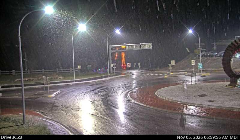
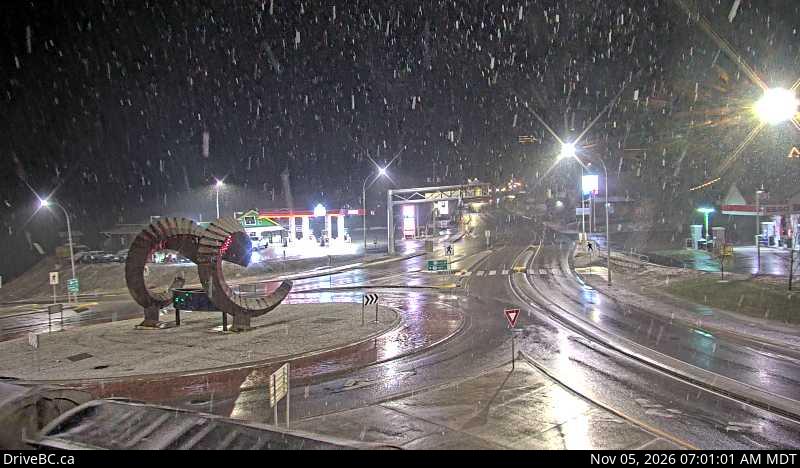
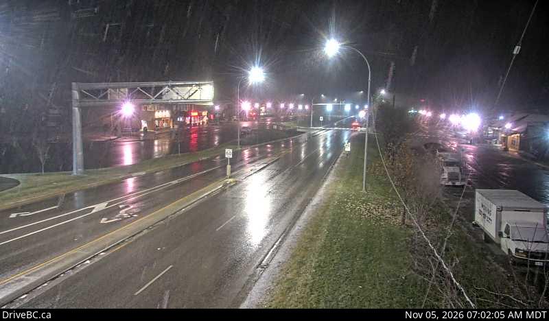
Radium Hotsprings Northbound – Hwy 93/95 roundabout, at Radium Hot Springs, looking northbound on Hwy 95.

Radium Hotsprings Eastbound – Hwy 93/95 roundabout, at Radium Hot Springs, looking eastbound on Hwy 93.

Radium Hotsprings Southbound – Hwy 93/95 roundabout, at Radium Hot Springs, looking southbound on Hwy 93/95.

Panorama West – On Toby Creek Road at Panorama Fire Hall, near Springs Creek Rd, looking to the west.

Panorama East – On Toby Creek Road at Panorama Fire Hall, near Springs Creek Rd, looking to the east.

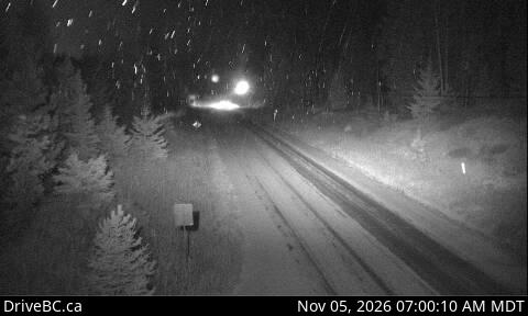
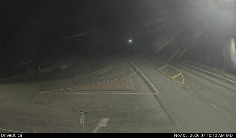
Canal Flats – Hwy 93 at Burns Avenue, looking south on Highway 93.

Wasa – Hwy 93/95 at junction of Hwy 95A, looking to the north.

Highway 93 is a north–south route through the southeastern part of British Columbia, in the Regional District of East Kootenay and takes its number from U.S. Highway 93 that it connects with at the Canada–United States border. It follows the Crowsnest Highway (Highway 3) and Highway 95 through Radium Hot Springs and to where it crosses the Continental Divide into Alberta at Vermilion Pass, where it continues as Alberta Highway 93. The section between the Canada-U.S. border and the Crowsnest Highway is known as the Elko–Roosville Highway, the section between the Crowsnest Highway and Radium Hot Springs is known as the Kootenay–Columbia Highway, while the section east of Radium Hot Springs is known as the Banff–Windermere Parkway.

From the international border crossing at Roosville, the 321 km (199 mi) long Highway 93 parallels the eastern shore of Lake Koocanusa for 36 km (22 mi) to where it meets the Crowsnest Highway (Highway 3) at Elko. Highway 3 carries Highway 93 west for 53 km (33 mi) to where it is handed off to Highway 95 just south of Fort Steele. Highway 95 carries Highway 93 north for another 134 km (83 mi) along the Kootenay River and the Columbia River passing through Wasa, Canal Flats, Fairmont Hot Springs and Invermere to Radium Hot Springs, where Highway 95 diverges north towards Golden.

Highway 93 leaves the concurrence and proceeds east from Radium Hot Springs for about 1.3 km (0.8 mi) to the western gate of Kootenay National Park. Through the park, the highway travels northeast along the Kootenay and Vermilion rivers for 93 km (58 mi) to Vermilion Pass and the Alberta border, where it is continues as Alberta Highway 93. After crossing the border, the highway continues for another 11 km (7 mi) to meet the Trans-Canada Highway (Alberta Highway 1) near Castle Junction.

Filed Under: Road Reports

Highway 15 Road Conditions

by

Highway 15 Road Conditions

Highway 15 – Border Cameras

Filed Under: Road Reports

Cariboo Road Conditions

by

Cariboo road conditions are Regional Highways Conditions for the BC Cariboo Area

Electrical maintenance at Horse Lake Road, In 100 Mile House and At Birch Ave and Cariboo Trail and Horse Lake Rd. Starting Fri Jul 10. Last update: September 15th, 2026 at 8:09pm PDT. Installation of new traffic signal. Watch for traffic control at intersection. Expect short holds to traffic during pole installation.
minor construction | last updated
Road maintenance from Olson Road, At Olson Road and Quesnel-Hixon Road to At Highway 97 and Olson Road. Starting Thu Sep 3 until Sun Nov 15. From 7:00 AM to 7:00 PM PDT, Monday to Saturday. Single lane alternating traffic. Last update: September 15th, 2026 at 8:10pm PDT. Road resurfacing and brushing.
minor construction | last updated
Utility work from Highway 1, 11km South of Cache Creek to 12km South of Cache Creek. Starting Mon Apr 27. From 8:00 AM to 4:00 PM PDT, weekdays. Single lane alternating traffic. Watch for traffic control. Last update: September 15th, 2026 at 8:09pm PDT.
minor construction | last updated
Road maintenance from Big Bar Road, At Big Bar Road and Hooke Road to At 3100 Forest Service Road and Big Bar Road. Starting Tue Aug 18. Single lane alternating traffic. Expect minor delays. Last update: September 15th, 2026 at 8:09pm PDT. Watch for crews and equipment working.
minor construction | last updated
Utility work from Highway 97, 19km Southeast of Clinton and Loon Lake Rd to 70 Mile House. Starting Mon Aug 17. Watch for traffic control. Last update: September 15th, 2026 at 8:09pm PDT.
minor construction | last updated | next update Wed Sep 30 at 12:00 PM PDT.
Washout at Little Lake-Quesnel River Road, 93km Northeast of Williams Lake. Closed. Last update: November 2nd, 2026 at 2:38pm PCT. Next update: April 2nd, 2027 at 12:00pm PCT. Road closed 10 km West of Likely Road Turnoff. No detour. No homes or driveways affected. No access to Quesnel River.
major incident | last updated
Construction work from Durrell Road, 17km South of Quesnel and Highway 97 to At Dale Lake Road and Durrell Road. Starting Mon Jul 13. Watch for traffic control. Expect minor delays. Last update: September 15th, 2026 at 8:11pm PDT.
minor construction | last updated | next update Thu Oct 1 at 10:00 AM PDT.
Bridge maintenance at Chilko-Newton Road, Chilko River Siwash Bridge. Starting Mon Jul 13. Expect delays. Weight vehicle restriction: 32,000KG. Last update: September 15th, 2026 at 8:09pm PDT. Next update time Mon Oct 26.
minor construction | last updated
Landslide at Cave Road, 13km North of Quesnel. Closed. Last update: August 25th, 2026 at 3:03pm PDT. Next update: April 12th, 2027 at 10:00am MST.
major incident | last updated
Landslide at Kersley-Dale Landing Road, 25km South of Quesnel and 500m from Highway 97 intersection. Closed. Last update: August 25th, 2026 at 3:09pm PDT. Next update: April 21st, 2027 at 3:00pm MST. A temporary Single Lane Gravel Road for Local Traffic via Arnoldus Road.
minor incident | last updated
Flooding at McKay Road, 41km Northwest of Williams Lake. Closed. Last update: August 25th, 2026 at 3:15pm PDT. Next update: May 1st, 2027 at 9:00am MST.
major incident | last updated
Road maintenance from Highway 97, 34km North of Quesnel to 25km Northeast of Quesnel. Starting Thu Apr 30. Single lane alternating traffic. Expect delays. Last update: September 15th, 2026 at 8:10pm PDT. Reduce speed, watch for crews at work.
minor construction | last updated
Bridge closed at Johnston Bridge Loop, In Quesnel and Front St. Last update: October 26th, 2026 at 10:45am PDT. Next update: December 28th, 2026 at 11:00am MST. Closed to all traffic. Detour via Plywood Rd and Maple Drive. Repairs underway. Industrial traffic is not allowed to detour through Johnston Subdivision.
major incident | last updated
Road construction at Highway 26, 54km East of Quesnel. Starting 8:00 AM PDT on Wednesday July 15, 2026 until 5:00 PM MST on Monday November 30, 2026. Single lane alternating traffic. Watch for traffic control. Last update: October 21st, 2026 at 2:13pm PDT. Culvert replacement. Work takes place 8:00 AM to 5:00 PM.
minor construction | last updated
Construction work from Highway 97, 34km North of Quesnel to In Quesnel. Starting Mon Jul 20 until Sun Nov 15. Single lane alternating traffic. Watch for traffic control. Last update: October 5th, 2026 at 9:16am PDT. Widening, drainage improvements and construction of the northbound left turn lane at the Highway 97-Olson Road intersection in addition to culvert replacement .
minor construction | last updated
Construction work at Quesnel-Hydraulic Road, 25km Southeast of Quesnel. Starting Wed Jul 22 until Thu Dec 31. Single lane alternating traffic. Watch for traffic control. Expect minor delays. Last update: September 15th, 2026 at 8:10pm PDT.
minor construction | last updated
Construction work at Highway 97, 34km North of Quesnel and Olsen Rd intersection. Starting Mon Aug 17 until Sun Nov 15. From 7:00 AM to 7:00 PM PDT, Monday to Saturday. Last update: October 5th, 2026 at 9:59am PDT. Intersection improvements. Intermittent lane closures in both directions. Speed reduction in place. Watch for traffic control.
minor construction | last updated
Debris on road from Pavilion Road, At Pavilion Road and Pear Lake Road to Pavilion-Clinton Road, At Mowich Road and Pavilion-Clinton Road. Closed to all traffic except emergency vehicles. Last update: October 23rd, 2026 at 1:55pm PDT. Next update: November 27th, 2026 at 12:00pm MST.
minor incident | last updated
Road construction from Highway 26, Wells Visitor Information Centre to At Pooley Street and In Wells. Starting Tue Oct 13 until Mon Nov 30. From 7:00 AM to 7:00 PM PDT, every day. Single lane alternating traffic. Watch for traffic control. Last update: October 14th, 2026 at 9:01am PDT.
minor construction | last updated
Tree pruning from Quesnel-Hydraulic Road, 4.5 Km Northwest of Bastin Road to At Bastin Road and Quesnel-Hydraulic Road. Starting Mon Oct 26 until Tue Nov 10. From 7:00 AM to 5:00 PM PDT, Monday to Saturday. Single lane alternating traffic. Watch for traffic control. Last update: October 14th, 2026 at 9:35am PDT.
minor construction | last updated
Construction work from Lillooet-Pioneer Road, At Lillooet-Pioneer Road and Yalakom Road and Yalakom Road to Gold Bridge. Starting Thu Oct 1 until Mon Nov 30. From 6:00 AM to 7:00 PM PDT, every day. Single lane alternating traffic. Shoulder closed. Watch for traffic control. Last update: October 15th, 2026 at 8:05am PDT.
minor construction | last updated
Utility work from Highway 20, At Thompson Road to At Cessna Drive. Starting Mon Oct 19 until Fri Nov 13. From 8:00 AM to 4:00 PM PDT, weekdays. Single lane alternating traffic. Watch for traffic control. Last update: October 15th, 2026 at 4:18pm PDT.
minor construction | last updated
Utility work from Gibraltar Mine Road, At Beaver Lake Road and Gibraltar Mine Road to Cuisson Lake Road. Starting 8:00 AM PDT on Monday October 26, 2026 until 4:00 PM MST on Friday November 27, 2026. From 8:00 AM to 4:00 PM PDT, every day. Single lane alternating traffic. Watch for traffic control. Last update: October 23rd, 2026 at 9:37am PDT. No work on STAT Holiday, November 11.
minor construction | last updated
Construction work at Mission Mountain Road, Terzaghi Dam tunnel. Starting 7:00 AM MST on Sunday November 1, 2026 until 5:00 PM MST on Friday November 27, 2026. From 7:00 AM to 5:00 PM MST, every day. Expect 20 minutes delay. Single lane alternating traffic. Watch for traffic control. Last update: October 27th, 2026 at 10:35am PDT. Tunnel Maintenance.
minor construction | last updated
Utility work from Highway 26, At Quesnel Canyon Road to At Fanslau Road. Starting 8:00 AM MST on Monday November 16, 2026 until 4:00 PM MST on Monday November 30, 2026. From 8:00 AM to 4:00 PM MST, weekdays. Single lane alternating traffic. Watch for traffic control. Last update: October 28th, 2026 at 4:09pm PDT.
minor construction | last updated
Muddy Sections and Slippery sections between Anahim Lake Road (near Anahim Lake) and Sawmill Creek Road (Tatla Lake). Last update: November 5th, 2026 at 5:40am PCT. Next update: November 5th, 2026 at 7:00am PCT.
minor road condition | last updated
Ditch maintenance from Highway 1, At Spences New Bridge to Venables Valley Road,. Starting 7:00 AM PCT on Monday November 2, 2026 until 4:00 PM PCT on Thursday November 5, 2026. Single lane alternating traffic. Last update: November 2nd, 2026 at 8:26am PCT.
minor construction | last updated
Utility work at Highway 24, 201m West of Rainbow Country Road. Starting 8:00 AM PDT on Monday October 19, 2026 until 4:00 PM PCT on Saturday November 14, 2026. From 8:00 AM to 4:00 PM PDT, every day. Single lane alternating traffic. Watch for traffic control. Last update: November 3rd, 2026 at 10:55am PCT.
minor construction | last updated
Muddy Sections and Slippery sections between Hunlen Falls Turner Lakes Trailhead (39 miles west of Anahim Lake) and Kappan Mtn Road (near Anahim Lake). Last update: November 5th, 2026 at 5:40am PCT. Next update: November 5th, 2026 at 7:00am PCT.
minor road condition | last updated
Utility work from Highway 97, 6km North of 100 Mile House to 2km North of 100 Mile House. Starting 8:00 AM PCT on Tuesday December 1, 2026 until 4:00 PM PCT on Wednesday December 30, 2026. From 8:00 AM to 4:00 PM PCT, weekdays. Single lane alternating traffic. Last update: November 4th, 2026 at 8:50am PCT.
minor construction | last updated
Utility work from Highway 97, 19km South of 100 Mile House to 23km South of 100 Mile House. Starting 8:00 AM PCT on Tuesday December 1, 2026 until 4:00 PM PCT on Wednesday December 30, 2026. From 8:00 AM to 4:00 PM PCT, weekdays. Watch for traffic control. Last update: November 4th, 2026 at 11:34am PCT. Work on shoulder.
minor construction | last updated
Slippery sections between Horsefly Road (78 miles south of Likely) and Quesnel Forks Road (Likely). Last update: November 5th, 2026 at 5:40am PCT. Next update: November 5th, 2026 at 7:00am PCT.
minor road condition | last updated

Complete Road Condition Reports for:

Hwy 97 – https://bchighway.com/report/hwy97

Hwy 24 – https://bchighway.com/report/hwy24

Hwy 20 – https://bchighway.com/report/hwy20

Hwy 16 – https://bchighway.com/report/hwy16

Cariboo Road Conditions

The Cariboo region of BC is located in the central interior of the province. It is situated between the Cariboo Mountains to the east and reaches west across the Fraser River plateau to the Coast Mountains. Major cities in the Cariboo region include 100 Mile House, Williams Lake and Quesnel. Cariboo road conditions

Filed Under: Area, Road Reports

Highway 18 Road Conditions

by

BC Highway 18 Road Conditions reports from Duncan to Lake Cowichan

Utility work from Highway 18, Paldi Road to Westwood Road. Starting 9:00 AM PCT on Monday November 16, 2026 until 4:00 PM PCT on Monday November 16, 2026. Right lane closed. Last update: November 2nd, 2026 at 12:08pm PCT.
minor construction | last updated

All Vancouver Island Road Conditions

Lake Cowichan

Lake Cowichan, is a town located on the east end of Cowichan Lake and, by highway, is 27 kilometres west of Duncan, British Columbia. The Cowichan River flows through the middle of the town.

British Columbia Highway 18 connects Duncan (via North Cowichan) to the town of Lake Cowichan to the west.

Highway 18 Road Conditons

Filed Under: Cameras, Road Reports Tagged With: Cam18

  • « Go to Previous Page
  • Go to page 1
  • Interim pages omitted …
  • Go to page 3
  • Go to page 4
  • Go to page 5
  • Go to page 6
  • Go to page 7
  • Interim pages omitted …
  • Go to page 10
  • Go to Next Page »

Primary Sidebar

Caribbean Business for Sale

Move to Sint Maarten with this incredible opportunity 

Best Personal Breathalyzer

Personal Breathalyzer
Dont risk a DUI. Make sure you don’t drive while impaired Get a personal breathalyzer check your alcohol levels and drive responsibly.


This 'travel news' services website is privately owned. It is not affiliated or sanctioned by the Government of BC, nor is it part of the provincial governments - DriveBC program or websites, operated by the BC Ministry of Transportation and Infrastructure. The data and electronic links provided in this web site are for informational purposes only and bchighway.com disclaims all responsibility for the accuracy of site content or linked information. This information obtained from bchighway.com should not be used as a basis for making financial or other commitments. Privacy Agreement © 1996–2026 bchighway.com - All Rights Reserved.